In this Carthage ruins in Tunis guide, we go beyond the usual list of things to see. We explain which ruins are worth seeing, what we know, what archaeologists believe, and what remains a mystery. You’ll also find practical information to help you plan your visit and understand what you are looking at when you arrive.
Disclaimer: This post contains affiliate links. If you click through and make a purchase, we may receive a small commission at no additional cost to you. This helps to support and run our blog. Thanks!
Why Trust Our Carthage Ruins Guide?
For this guide, we’ll combine our experience with archaeological research and information from reliable sources. We’ll clearly separate our own observations from facts and archaeological theories, so you can see where the information comes from. We believe useful travel advice should tell you what a place is really like, rather than repeat how impressive it is.
Quick Answers: Carthage Ruins in Tunis – Worth the Detour?
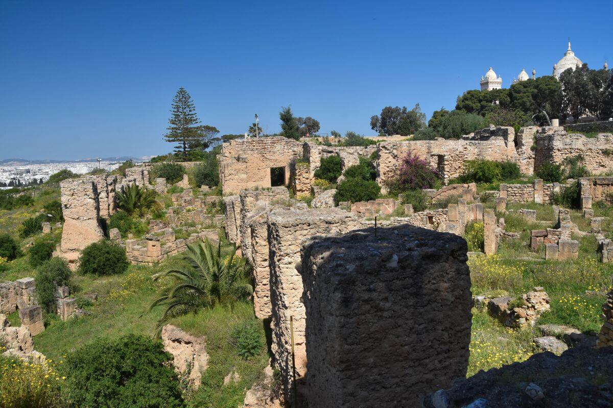
- LOCATION: Tunisia
- NEAREST CITY: 15 to 18 km (9 to 11 mi) northeast of central Tunis
- UNESCO STATUS: UNESCO World Heritage Site, inscribed in 1979
- DIFFICULTY: Moderate. The difficulty comes from how the ruins are spread out. This isn’t one single park but a collection of over 10 scattered archaeological areas mixed directly into a modern residential suburb.
- TIME NEEDED: 2 hours to see the highlights, 3-4 hours to explore properly, full day: Carthage + Sidi Bou Said/Tunis. If you have only 2 hours, prioritise Byrsa Hill, the Antonine Baths, and Punic Ports.
- BEST TIME: Morning to beat the large cruise ship tour groups.
- WORTH VISITING? Yes, especially if you enjoy archaeology.
- WHO SHOULD VISIT: First-time visitors to Tunisia, history buffs, UNESCO hunters, view seekers, active walkers, and photography lovers.
- WHO MAY FIND IT CHALLENGING: People sensitive to intense heat and travellers expecting a single park (the ruins are highly scattered). Anyone with mobility issues should also plan carefully.
- BIGGEST ATTRACTIONS: The Antonine Baths, Byrsa Hill and Citadel, the Punic Ports
- GUIDE WORTH IT? Yes, because the site has very few explanatory signs.
- BEST STRATEGY: Carthage Ruins + Sidi Bou Said, or Carthage Ruins + Tunis Medina + the Bardo National Museum
- WHEELCHAIR ACCESSIBLE: Not fully wheelchair accessible.
BOOK YOUR ONCE IN A LIFETIME EXPERIENCE BELOW:
Surprising Facts about Carthage ruins in Tunis
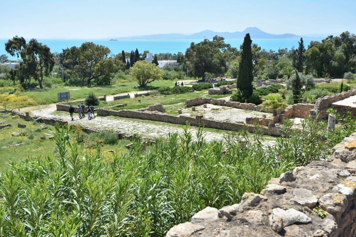
- ‘New City’ was its original name. The Phoenicians called their settlement Qart-Hadasht, which translates simply as ‘New City’. Greek and Roman speakers later changed the pronunciation, eventually giving us the name we use today.
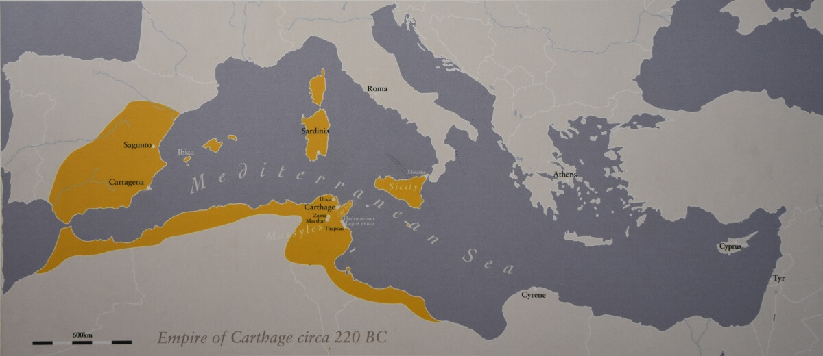
- A trading empire that reached across the Mediterranean. This was no small coastal settlement. Its trading network stretched across North Africa, Spain, Sicily, and Sardinia. Carthaginian merchants traded some of the ancient world’s most valuable goods, including silver from Spanish mines. They also traded tin and the highly prized purple dye produced from murex sea snails.
- Their warships were surprisingly organised. The Carthaginians were remarkably skilled shipbuilders. Long before modern mass production, they invented pre-fabricated shipbuilding. Evidence suggests they used a clever system of standardised wooden components. They stamped numbers onto wooden parts so workers could construct large warships like a puzzle in just days.
- When the Romans captured a Carthaginian warship during the First Punic War, they studied its construction. Ancient historian Polybius recorded that the Romans used the captured vessel as a model when building their own fleet.
- Six-storey buildings. Long ago, the city was much more crowded than its quiet ruins look today. Ancient historian Appian noted houses reaching six storeys high to save space. Excavations have also revealed sophisticated drainage pipes and plumbing systems, proving how modern the city was over 2,000 years ago.
- The Two Capitals: Carthage in today’s Tunisia became the capital of two very different powers during its long history. First, it was the capital of the independent Punic Empire, and later the administrative capital of the Roman province of Africa.
Don’t forget to bookmark this Carthage ruins in Tunis guide so you can quickly find it.
A Short History of Carthage in Tunisia
The story of the Carthage ruins in Tunisia is anything but simple. The city grew from a Phoenician settlement into the capital of a powerful Punic empire. It fought Rome in three brutal wars, was destroyed, rebuilt as a Roman metropolis and eventually disappeared beneath centuries of change. Understanding that story makes the scattered remains much easier to read when you visit this archaeological site.
FROM PHOENICIAN COLONY TO MEDITERRANEAN POWER
- HISTORICAL FOUNDATIONS:
The city’s story began around the 9th century BC, when Phoenicians from Tyre established a settlement on the Gulf of Tunis. UNESCO notes that from the 6th century onwards, it developed into a great trading empire. It covered much of the Mediterranean and was home to a brilliant civilisation.
- THE MYTHOLOGICAL ORIGINS OF THE CITY:
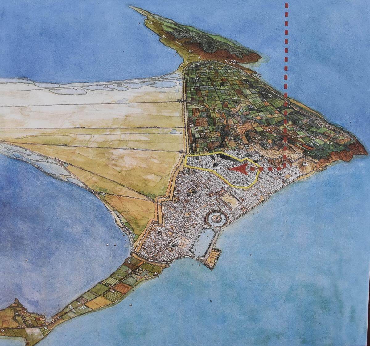
The traditional founding date is 814 BC, and legend gives the honour to legendary Queen Dido. According to the story, she fled Tyre and negotiated with the local ruler for enough land to establish a settlement. He offered her only as much ground as could be covered by an ox hide. Dido found a clever solution; she cut the hide into incredibly thin strips and used them to surround the hill. That hill became Byrsa (yellow outline), which later formed the heart of the new settlement.
The Dido story is famous, but her historical existence has never been proven. So, this story is best treated as legend rather than proven fact.
THE CITY THAT CHALLENGED ROME
Over the following centuries, the settlement grew into the capital of the Punic Empire, with influence stretching across much of the western Mediterranean. Its wealth came from trade, agriculture, ports, and control of important sea routes.
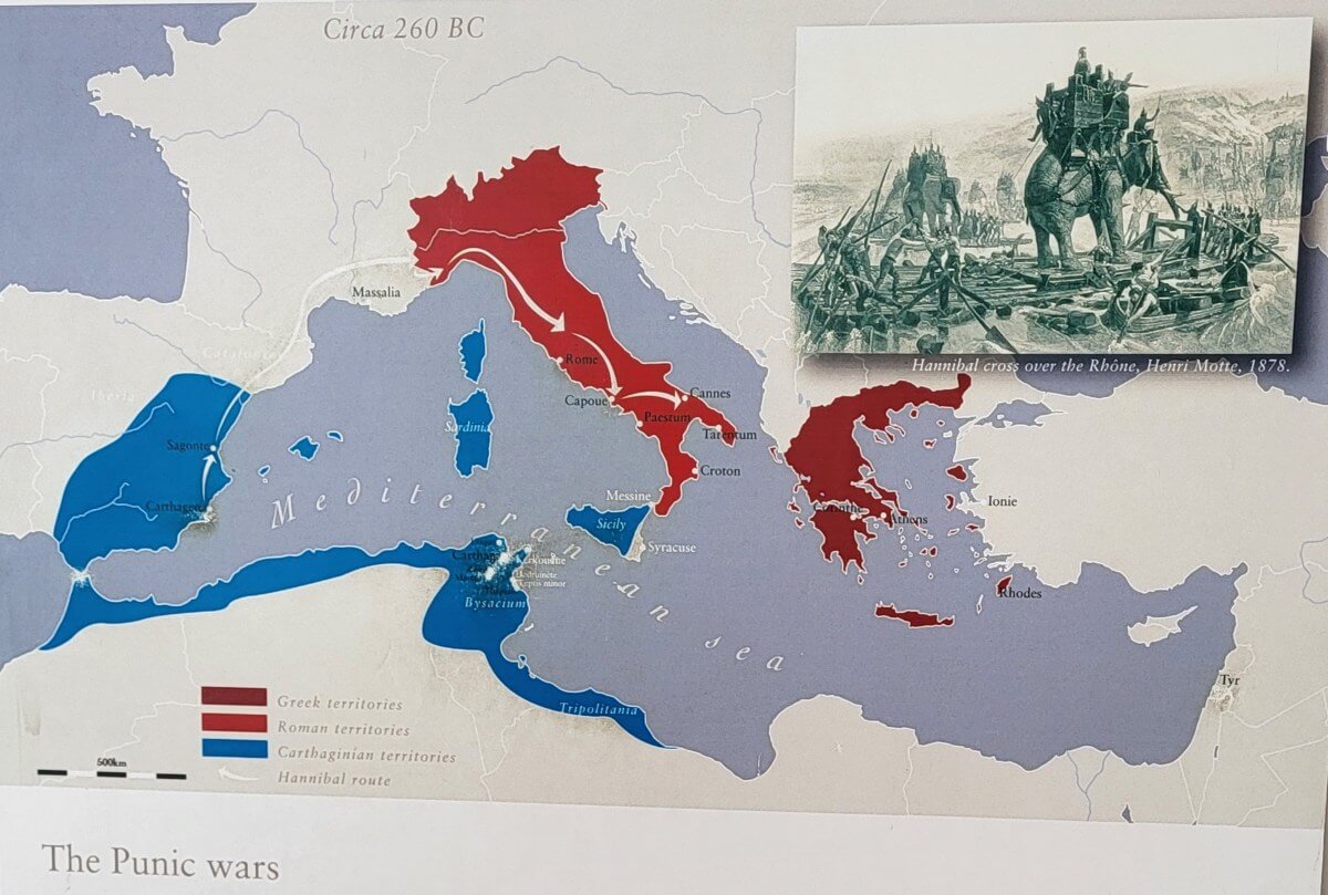
The growing Punic power eventually collided with Rome. Historical records note the rivalry produced the three Punic Wars, fought between 264 and 146 BC. The second brought the legendary Carthaginian general and statesman Hannibal. His invasion of Italy with his army and elephants, marching across the Alps, became one of history’s most famous military campaigns. The final war ended in 146 BC. After a long siege, Rome captured and destroyed the city, and its territory became the Roman province of Africa.
DESTROYED, THEN REBORN
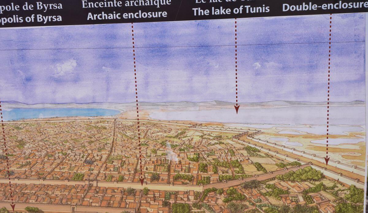
Julius Caesar realised how valuable the location was for trade and shipping. The general and former Roman dictator planned to establish a Roman colony on the abandoned site. However, he was assassinated before the project could be completed. Historical records note that his adopted son Augustus continued the settlement and development of Roman Carthage. UNESCO confirms that a second Roman city was later established on the ruins. By the Roman period, the new city had become a major centre of North Africa.
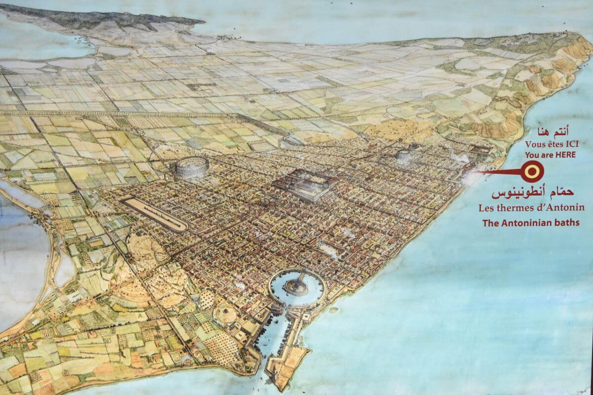
The Roman city grew rapidly, with grand public buildings, baths, an amphitheatre, and wealthy residential districts. It also became an important centre of Christianity.
FINAL FALL
Roman rule eventually gave way to the Vandals, who captured the city in 439 AD. The Byzantine Empire took it back in 533 AD, but their rule didn’t last forever. In 698 AD, Arab armies conquered the city. Roman Carthage faded from its former importance, and the nearby city of Tunis became the region’s dominant centre. The old settlement slowly became buried beneath time, later development and new layers of occupation.
This is why the archaeological site you see today is so unusual. It’s a physical record of Phoenician, Punic, Roman, Vandal, Byzantine, and later history, all occupying the same landscape. UNESCO lists remains from these successive periods across the World Heritage property.
Suggested Itinerary: The Best Way to Explore the Carthage Ruins in Tunisia
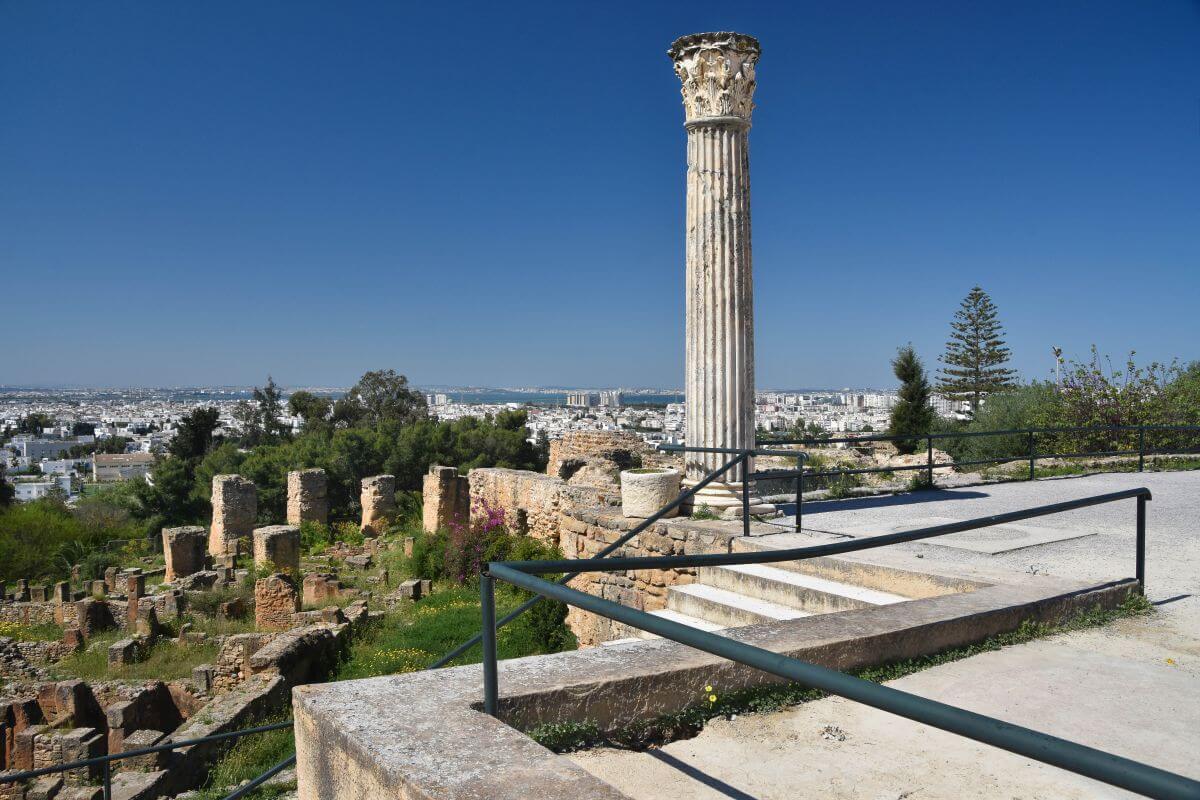
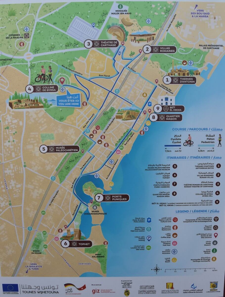
The biggest mistake you can make is treating the archaeological areas like one attraction with one entrance. The Carthage ruins are spread out, so your transport determines the smartest route. After exploring it ourselves in April 2026, we recommend a different order depending on whether you arrive by taxi or the TGM train.
A combined ticket allows you to visit the main archaeological areas, so you can move between them without buying another ticket at every stop. So, the real challenge is deciding where to start and where to finish. The TGM is especially useful because its stations run through the archaeological zones, with several stops serving different parts of the site.
Suggested Itinerary of the Carthage Ruins If Arriving by Taxi from Tunis (Start Inland and Finish by the Sea)
- Amphitheatre. First, ask your driver to take you to the amphitheatre. Start here because it is one of the most inland sites and awkward to reach on foot from the coastal ruins.
- Byrsa Hill & Saint Louis Cathedral
- Roman Theatre. Its position on the hill makes this a natural continuation of the route.
- Odeon & Roman Villas.
- Paleo-Christian Museum.
- Antonine Baths.
- Punic Ports.
- Tophet.
Arriving by TGM from Tunis? Reverse the Route and Go South to North
If you arrive from Tunis by TGM train, don’t copy the taxi itinerary of the Carthage ruins. The train follows the coast, so start at Carthage-Salammbo, where the Tophet and Punic Ports are close by. Then take the train north to Hannibal for the Antonine Baths and continue through the Roman sites towards Byrsa.
The TGM station order is Salammbo ➡ Byrsa ➡ Dermech ➡ Hannibal ➡ Presidence.
Your order should, therefore, be:
Tophet ➡ Punic Ports ➡ Antonine Baths ➡ Paleo-Christian Museum ➡ Odeon & Roman Villas ➡ Roman Theatre ➡ Byrsa Hill ➡ Amphitheatre.
For the final amphitheatre, take a short taxi from the Byrsa area rather than attempting the longer walk. You can then return (by taxi to TGM station) or continue towards Sidi Bou Said for an easy second trip. For us, these two itineraries are the most sensible ways to explore Carthage ruins in Tunisia. Work with the geography instead of fighting it.
HOW TO GET THERE FROM TUNIS:
To visit the ruins, catch the TGM train from Tunis Marine station heading towards the final stop, Marsa Plage. The ride to Salammbo takes about 24 to 28 minutes. Trains run every 10 minutes at peak hours and every 20 minutes off-peak. As of September 2026, a ticket costs just 0.70 to 1.25 Tunisian Dinars, depending on the class. If you stay on the train for a few more stops past the archaeological site, you can easily visit the famous UNESCO-listed blue-and-white village of Sidi Bou Said on the same trip.
Things to See
1. Amphitheatre of Carthage
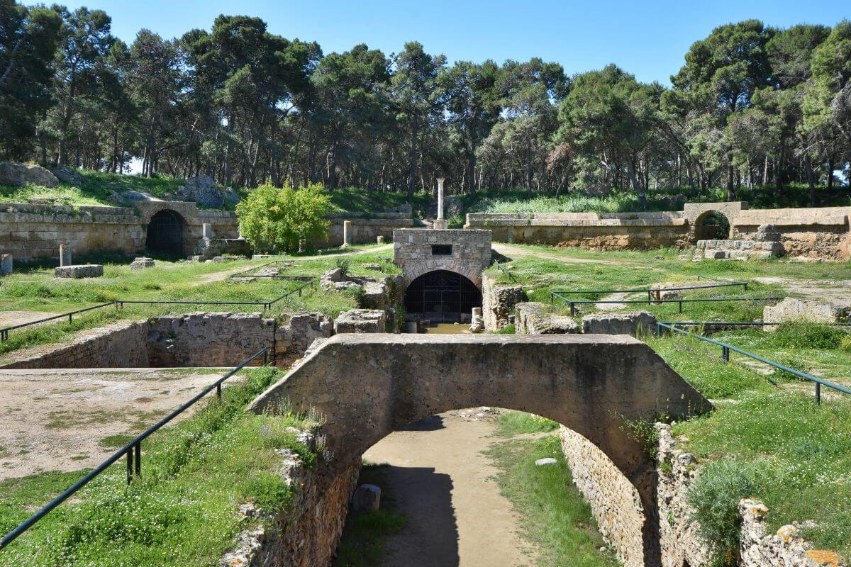
The first thing that surprised us about this site wasn’t its size, but how little of it is left. Standing among the trees, it’s difficult to imagine thousands of people filling the seats and waiting for the next gladiator fight or wild-animal hunt. Yet this was once one of the great entertainment buildings of Roman North Africa.
That is exactly what makes this amphitheatre one of the most interesting stops among the Carthage ruins in Tunisia. The building has lost almost everything above ground, yet the remains still reveal how ambitious the Romans had become. When we visited the amphitheatre, we were the only people exploring the site. The only other person nearby was a very friendly local man living in the surrounding woodland, who was simply cooking his lunch.
WHAT WE KNOW:
- Location and early days. Archaeologists believe this Roman amphitheatre was built west of Byrsa Hill, probably in the late 1st or early 2nd century AD.
- Colossal scale and capacity.
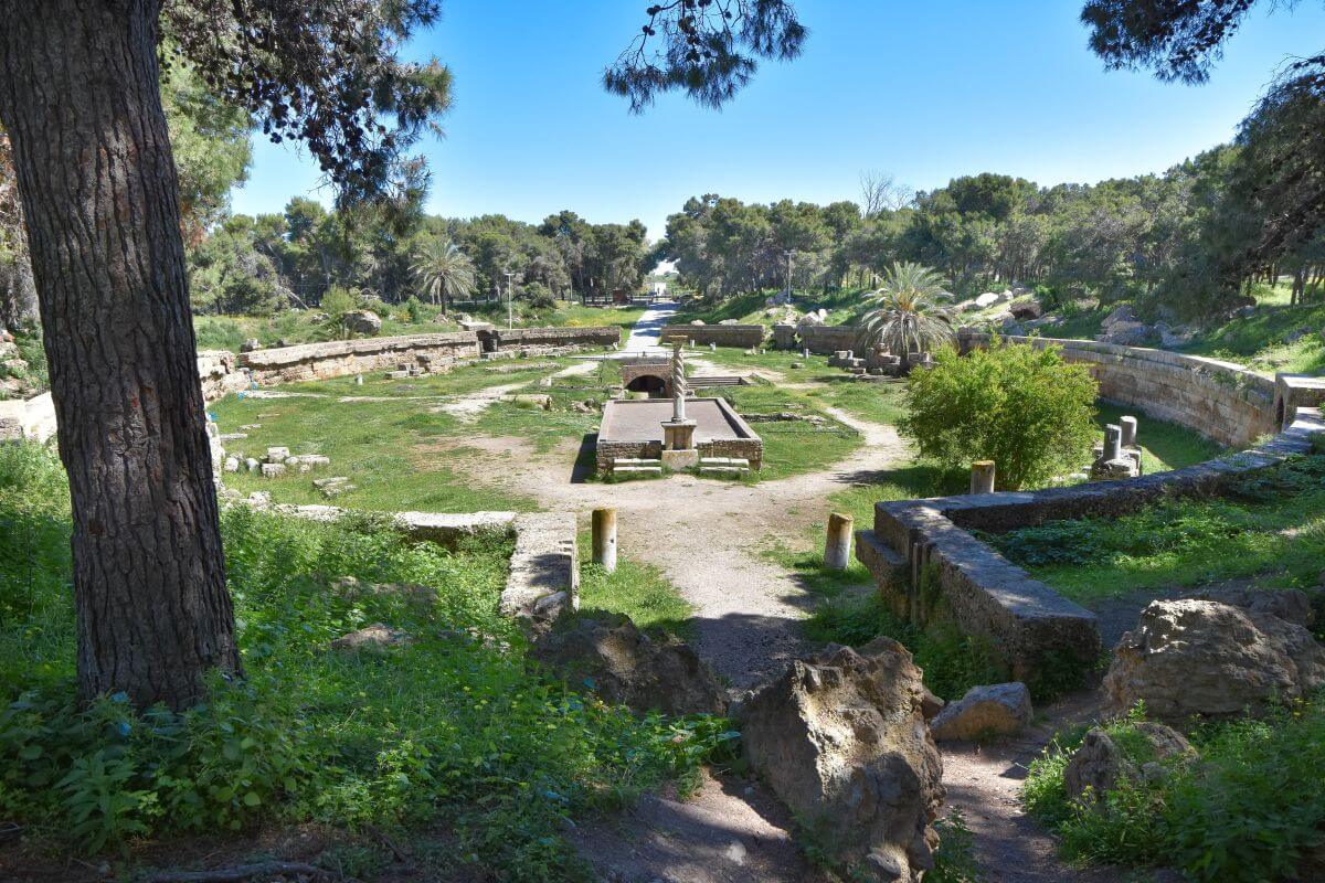
After its expansion, the structure measured about 156 m (511 ft) long and 128 m (419 ft) wide. Its estimated capacity is approximately 30,000 spectators. That puts it among the largest arenas of Roman North Africa.
- Unique structural engineering. Its design was unusual for North Africa because it stood on level ground rather than being carved into or supported by a natural hillside. Its architectural connections are particularly interesting because researchers see stronger links with Romano-Campanian amphitheatre traditions than with many other North African examples. El Jem is the major North African comparison.
- Dimensions.
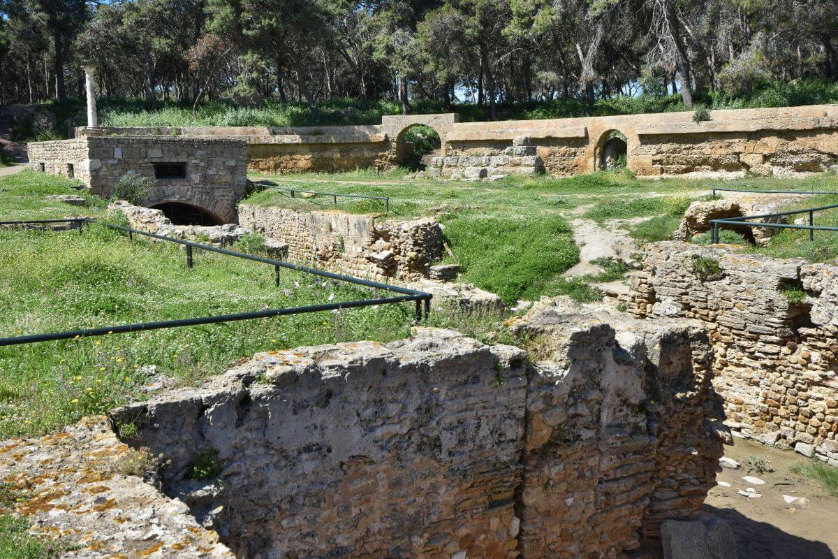
This was not a small local entertainment venue. The amphitheatre was built on the scale expected in a major Roman city. The arena measured approximately 65 m by 37 m (213 ft by 121 ft). Around it were tiers of seating and a service area. Underground passages helped the building function as a massive entertainment complex.
- An imperial capital showpiece. People came here to watch gladiator fights, animal hunts, and other public spectacles. Later, public executions also became part of the brutal entertainment.
WHAT ARCHAEOLOGISTS BELIEVE:
- The doubled expansion.
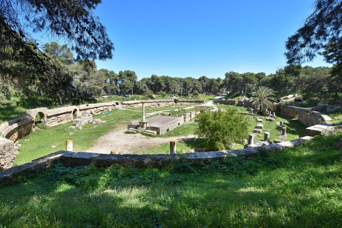
Archaeological studies suggest that the structure underwent major rebuilding and expansion. Its capacity almost doubled during the Roman period.
- Class segregation. The seating followed Roman social hierarchy. The best places were reserved for important members of society. Ordinary spectators occupied higher sections.
- Legend vs archaeological proof. The amphitheatre is traditionally identified with the martyrdom of two famous early Christian saints. However, historians cannot prove with complete certainty that Perpetua and Felicity were executed here in 203 AD.
WHAT REMAINS A MYSTERY:
- Unknown appearance.
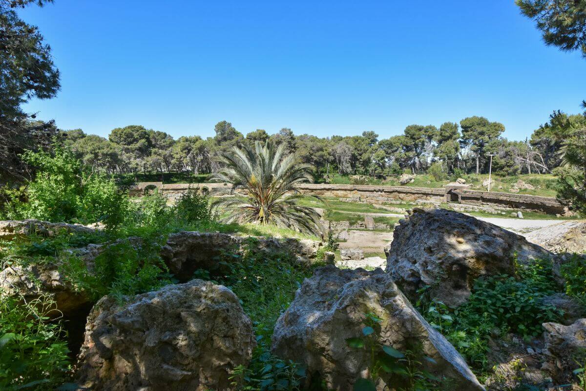
One of the biggest unanswered questions is what the complete amphitheatre looked like. Numerous centuries of stone robbing stripped away much of the structure. Locals removed valuable blocks and reused them elsewhere, leaving the upper sections almost completely gone.
VERDICT:
Don’t skip the amphitheatre simply because less of it survives. If you want to understand the scale of Roman Carthage, this is one of the places where the missing stones almost tell as much of the story as the ones still standing.
2. Byrsa Hill and Saint Louis Cathedral
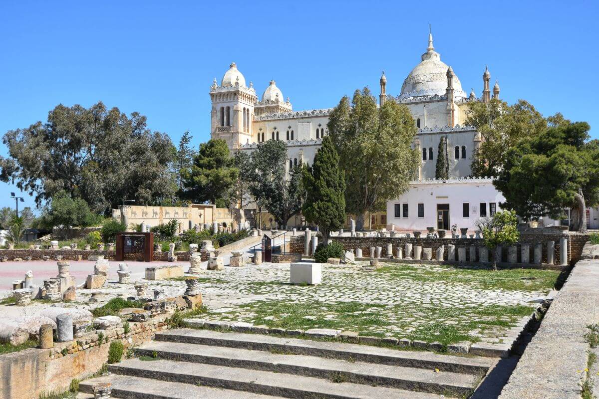
Byrsa Hill looks like the perfect place for panoramic views. It was the highest point of the ancient city and one of its most important centres. The most interesting thing isn’t what you can see across the landscape but what it’s hiding beneath you. Today, you can walk among excavated Punic homes and stand on ground reshaped by Roman engineers. You can also enter a beautiful 19th-century Saint Louis Cathedral, now known as the Acropolium.
WHAT WE KNOW:
- Life on the Hill.
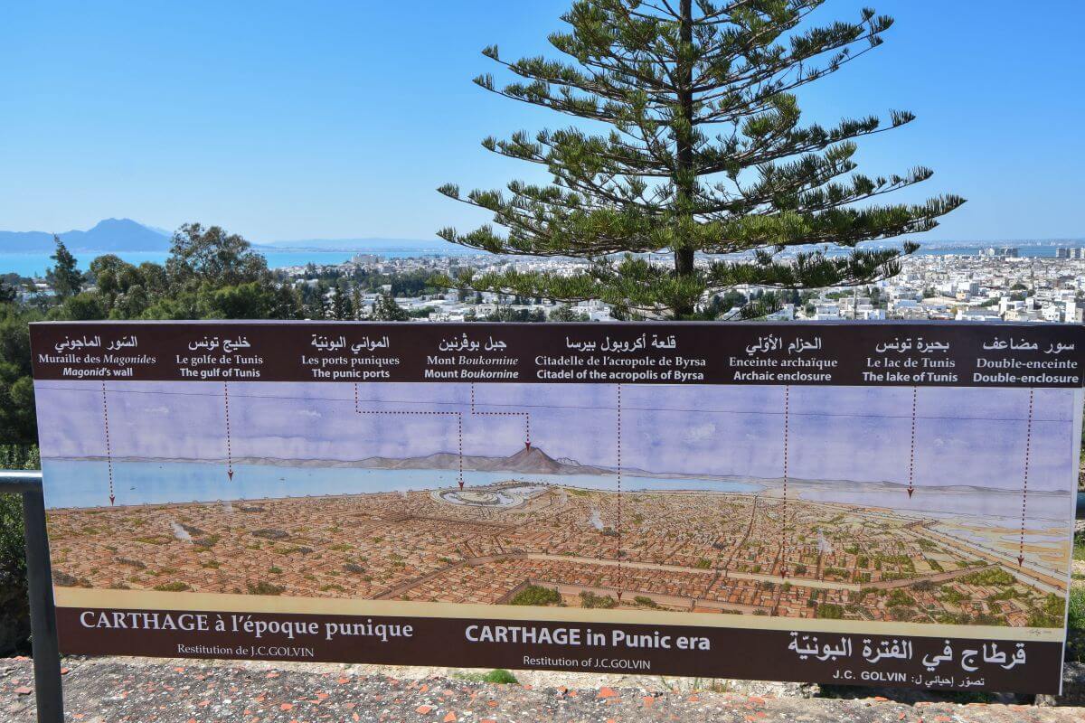
Byrsa Hill was once the heart of the Punic city. Ancient writers and the site’s informational panel note the summit held the Punic citadel. The Romans conquered and destroyed the citadel in 146 BC.
- Very little of the ancient Punic city survives.
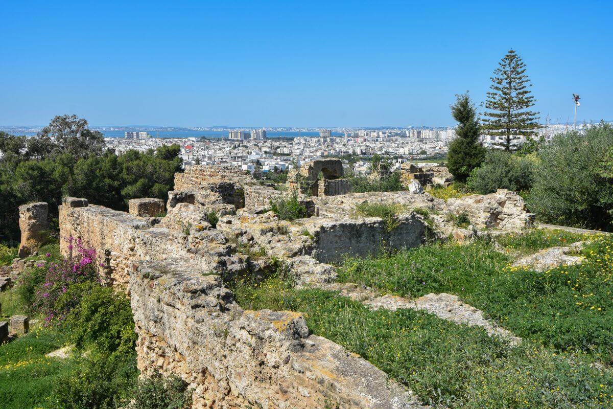
Most of what you see is actually Roman, Vandal, or Byzantine. The absence of the ruins is due to deliberate destruction and a rebuilding program. Only fragments from Punic Carthage have survived (on the picture). Don’t miss traces of a metal workshop and a multi-storey housing compound from the 2nd century BC. Also don’t miss the ancient cemetery, a tomb of a young man, known as ‘The Young Man of Byrsa’, right on the slope.
- The Hannibal Quarter (2nd century BC).

The residential area of the multi-storey housing compound is the absolute highlight. The excavated Hannibal Quarter contains remains of the wealthy Punic homes built on the steep hillside. Evidence suggests some of those houses reached five or six storeys, connected by narrow and steep stairs. Residents also had private ground cisterns and clay pipes for collecting water.
- The levelling of Byrsa Hill.
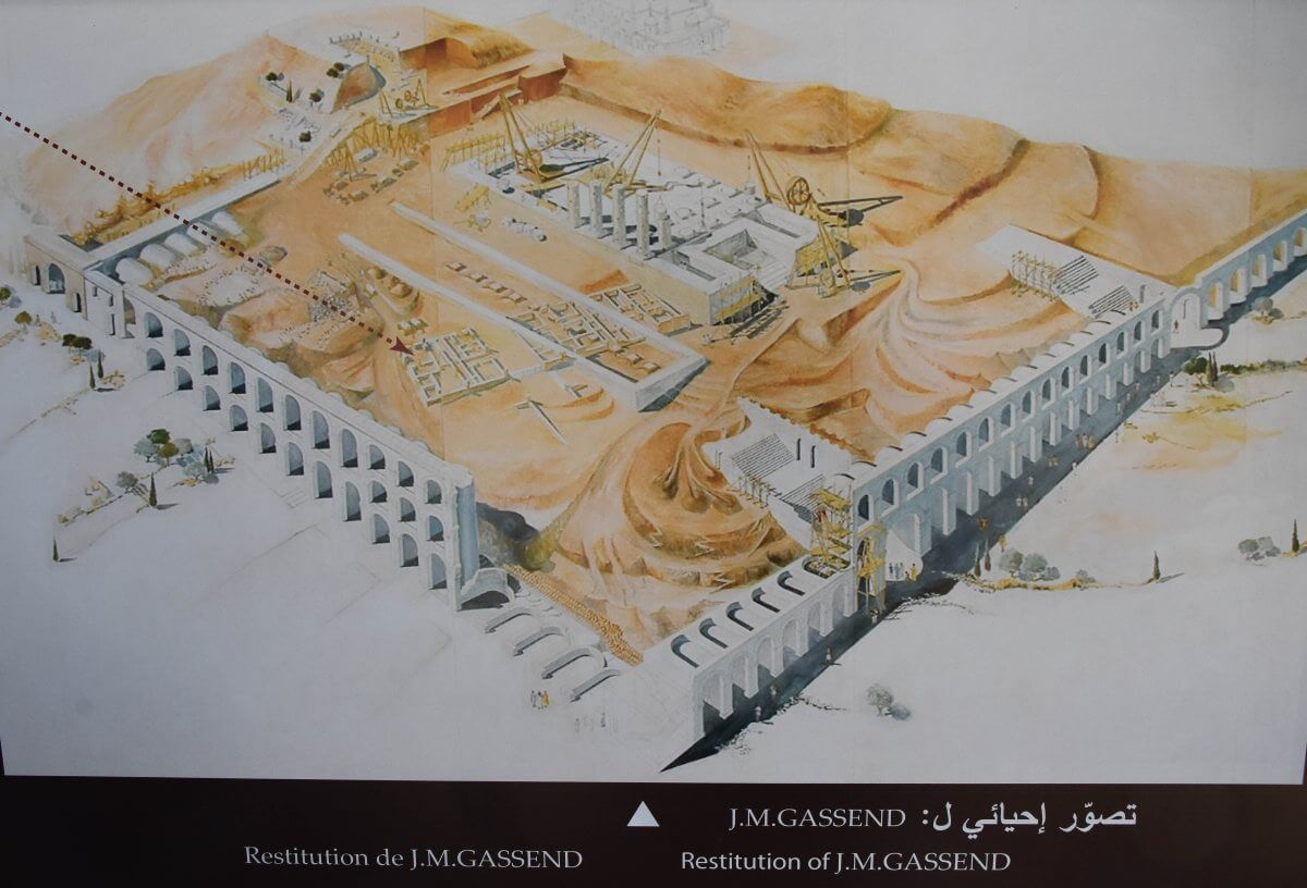
After the destruction of Punic Carthage, the Romans radically reshaped the summit. Information panels note that under Augustus, enormous engineering works transformed the uneven hilltop into a level platform. The new level became an important centre of Roman Carthage, with a forum and major public buildings, including the judiciary basilica, the library, and the capital.
- The slopes.
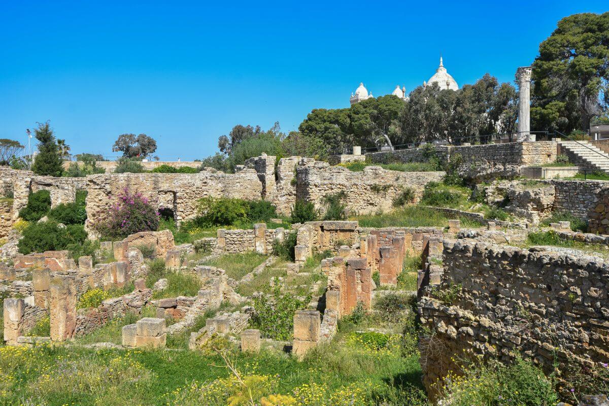
Because the Romans flattened the very top of Byrsa Hill to build their own city, the best-preserved Punic structures survived just below the summit.
WHAT ARCHAEOLOGISTS BELIEVE:
- The destruction of 146 BC. Archaeologists believe Byrsa Hill played a crucial role in the final days of Punic Carthage. Ancient accounts describe Roman soldiers fighting their way towards the citadel in 146 BC.
WHAT REMAINS A MYSTERY:
- The lost citadel of Byrsa Hill. The biggest mystery is what exactly stood on the summit before the Romans remodelled it. The original appearance of the Punic citadel remains difficult to reconstruct.
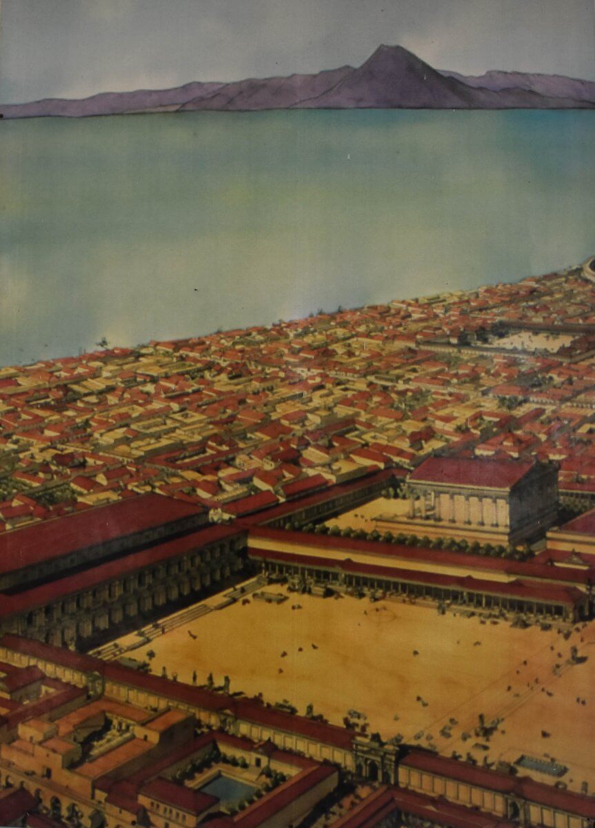
The Byrsa Hill. The image shows a reconstruction of the Roman city at the end of the 2nd century AD.
Saint Louis Cathedral
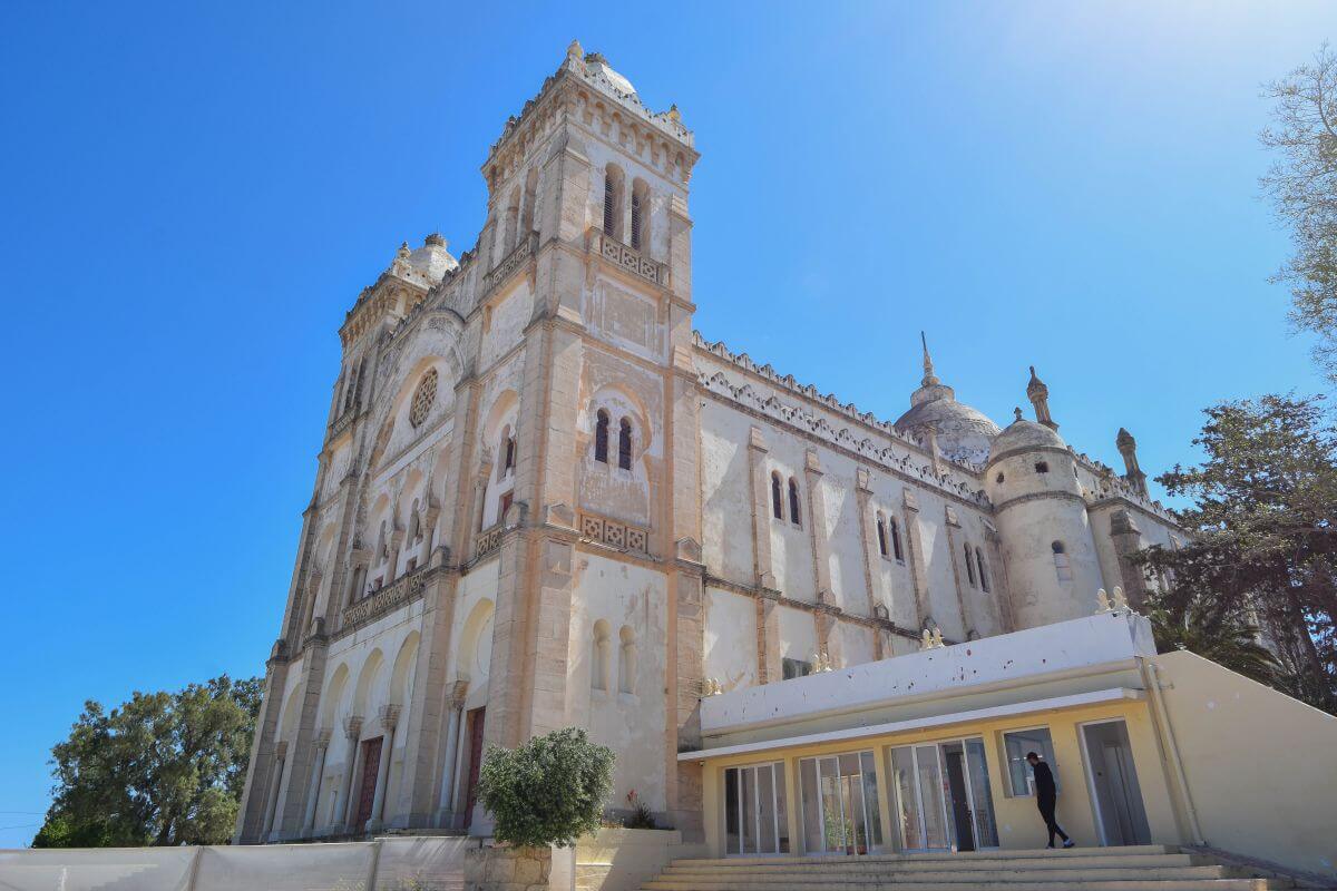
Saint Louis Cathedral sits on the peak of Byrsa Hill above all the ancient ruins.
WHAT WE KNOW:
- The 19th-century crusade memorial. The French built the cathedral between 1884 and 1890. The former cathedral commemorates King Louis IX of France, who died here in 1279 during the Eighth Crusade.
- Byzantine-Morish Architecture.
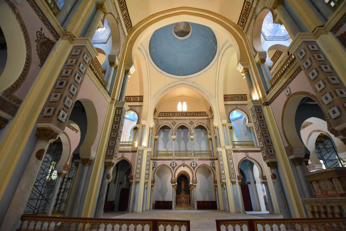
A striking Byzantine-Morish style, with a richly decorated interior, is impossible to miss. Inside, you’ll find 174 marble columns with gilded capitals and painted wooden ceilings.
- The cultural venue. Today, it’s known as the Acropolium rather than functioning as a regular church. The locals use its enormous interior for cultural events and concerts.
- Empty memorial. Inside, you’ll find an empty monumental memorial to Louis IX. His remains were taken back to France, leaving the grand tomb empty.
WHAT ARCHAEOLOGISTS BELIEVE:
- The Temple of Eshmun. Archaeologists believe the summit was home to a major temple dedicated to Eshmun, the Punic god of healing. The location makes sense for such an important sanctuary, but much of its original layout remains inaccessible. Today, the cathedral occupies the area, making investigation of what lies directly beneath it extremely difficult.
WHAT REMAINS A MYSTERY:
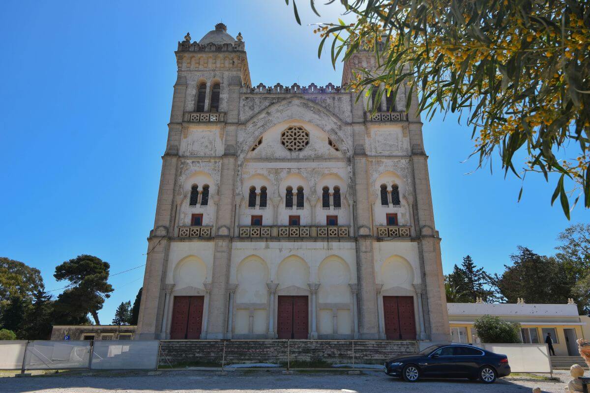
- The lost temple trapped beneath the platform. Because the later Saint Louis Cathedral occupies the summit, archaeologists cannot simply excavate beneath it to reveal its complete plan.
OUR VERDICT:
We found Byrsa Hill particularly rewarding because it gives you more than a famous viewpoint. You can actually see the remains of ordinary homes and imagine the people who once climbed these steep streets and collected rainwater. Allow enough time to explore the excavations rather than simply taking a photograph of the cathedral. Byrsa Hill is where Carthage’s layers become easiest to see. You can spot Punic homes beneath your feet, Roman monuments above them and a cathedral dominating the summit.
Carthage National Museum
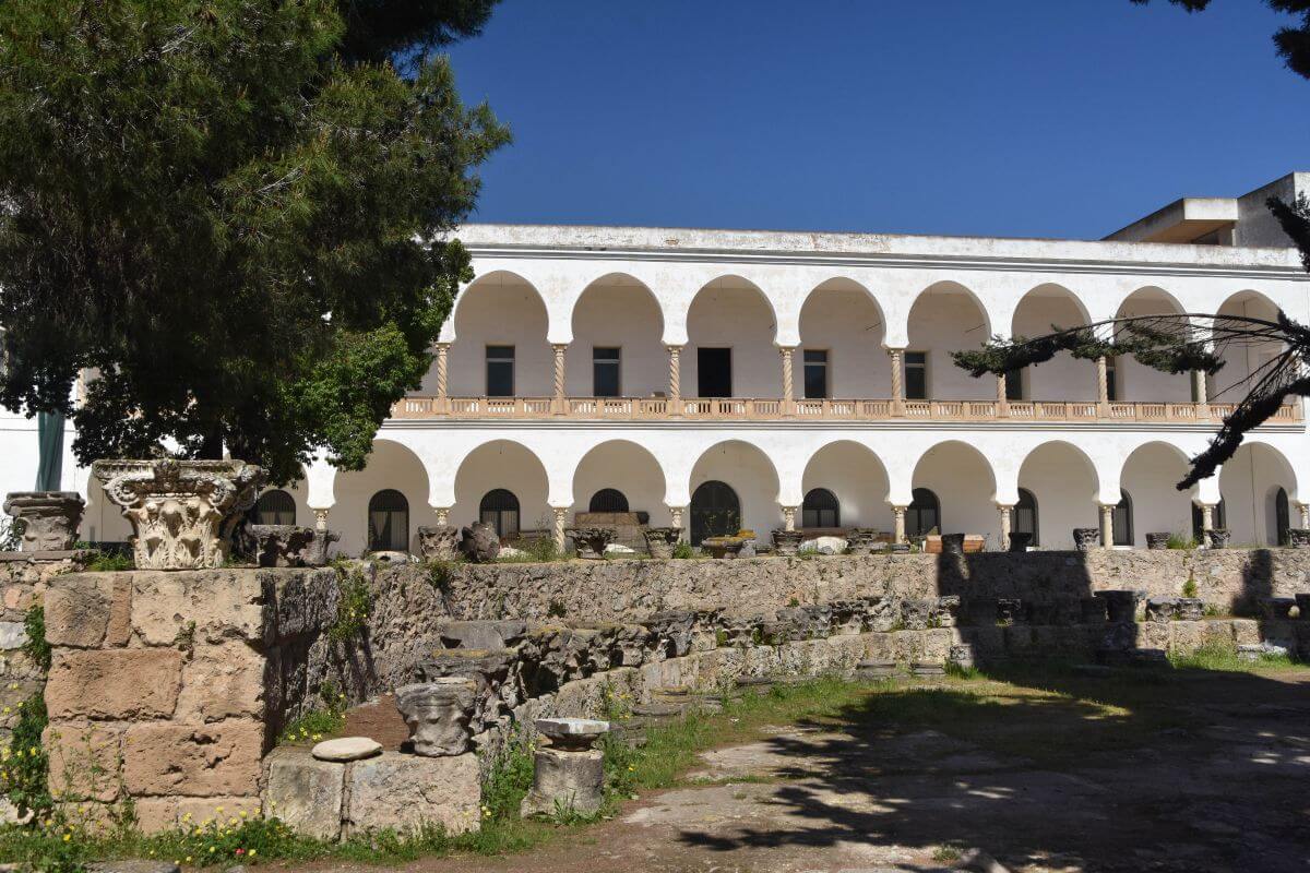
We were disappointed to discover that the Carthage National Museum, located on Byrsa Hill, is currently closed for renovation. The museum has been closed since 2018, with reopening expected towards the end of 2026, but dates can change. Check the official information before your trip rather than assuming the museum will be open.
3. Roman Theatre of Cartage
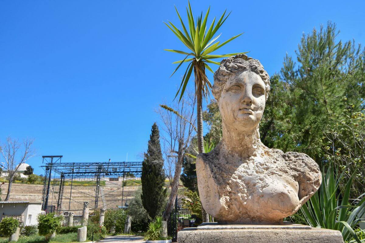
From Byrsa Hill, continue downhill towards the Roman Theatre, another enormous entertainment building from the Roman period. Much of what you see today is reconstructed. Here, you’ll need to look beyond the modern stonework to understand what once stood here.
WHAT WE KNOW:
- Buried deep under the soil. The Roman Theatre dates from the 2nd century AD, and archaeologists excavated it between 1901 and 1956. The Tunisian Ministry of Cultural Affairs notes that they found the first structures beneath approximately 8 m (26 ft) of soil.
- It’s a giant.
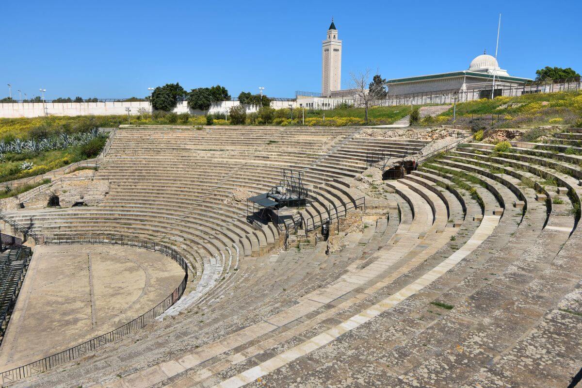
The original building was enormous. Archaeologists explain that the Roman Theatre of Carthage was the second-largest Roman theatre in Africa, surpassed in size only by the theatre at Utica. It could accommodate at least 5,000 spectators.
- Built with imported marble and stone. Ancient inscriptions refer to a richly decorated stage with marble and porphyry columns. Excavations also uncovered numerous statues. Among the most famous is a statue of Apollo playing a lyre, now displayed at the Bardo National Museum in Tunis.
- Its modern stage. Since 1964, this heavily reconstructed venue has returned to cultural use and hosts the International Festival of Carthage.
WHAT ARCHAEOLOGISTS BELIEVE:
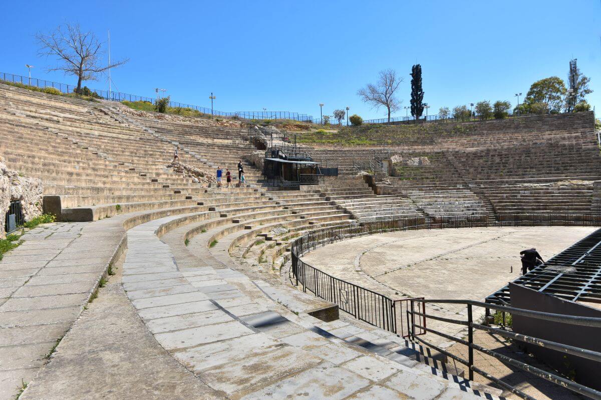
- A hybrid of Greek and Roman design. The theatre’s architecture is particularly interesting because archaeologists describe it as a hybrid between Greek and Roman theatre design. Greek theatres commonly used natural slopes for the seating, while Roman theatres could stand more independently on vaulted structures. Here, the builders combined both approaches, using the hillside while supporting the seating with a complex system of vaults.
- Vandal destruction. Archaeological evidence also points to a violent end. The Vandals destroyed the theatre in the 5th century. After that, a poorer population occupied the area.
WHAT REMAINS A MYSTERY:
- The theatre we no longer see. We cannot say exactly how tall the original seating rose and how the complete stage backdrop looked.
4. Park of the Roman Villas of Carthage
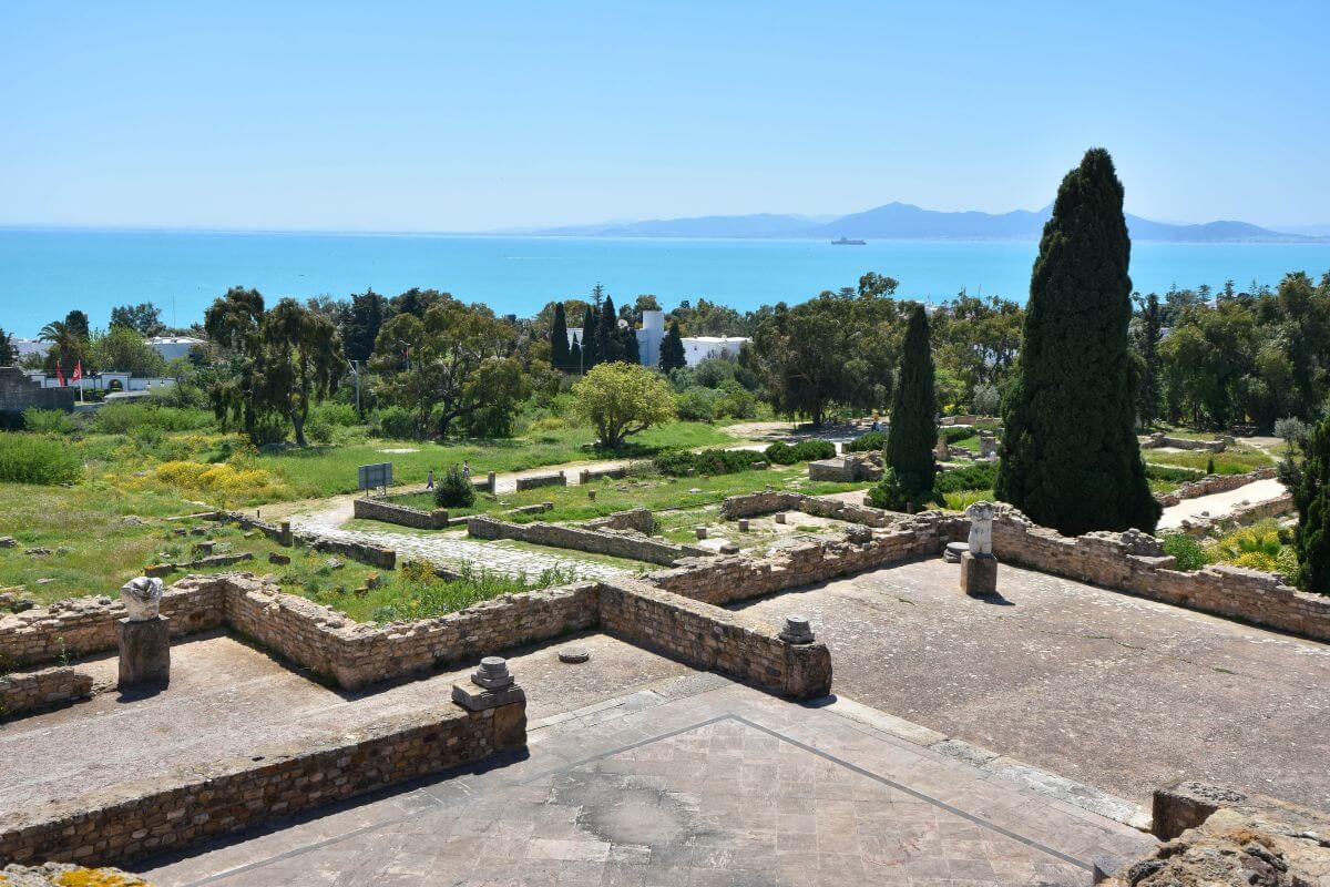
After the enormous public monuments, this stop reveals a completely different side of ancient life. Walk down the hillside, and suddenly you are no longer looking at where thousands of people watched gladiator shows. Here, wealthy Roman residents lived behind decorated walls, entertained guests in grand rooms and covered their floors with extraordinary mosaics. Among the Carthage ruins in Tunisia, the Park of the Roman Villas gives one of the clearest glimpses into the private world of the city’s richest residents. The surviving walls are unfortunately fragmentary, so you need some imagination. Look down at the floors; this is where the site becomes particularly interesting.
WHAT WE KNOW:
- Built over an older cemetery.
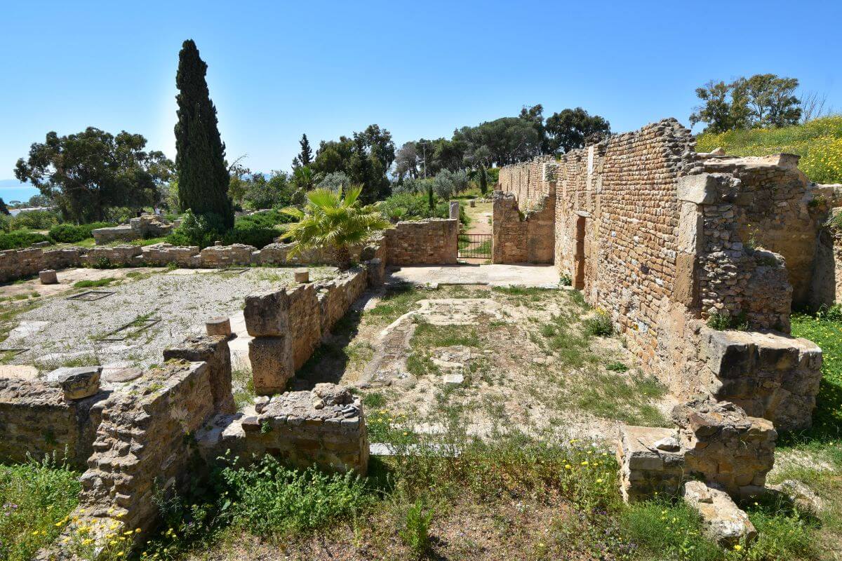
The Romans built a residential district on Odeon Hill over a much older Punic necropolis dating from the Hellenistic period. The official Tunisian heritage authority says the neighbourhood was divided into urban blocks measuring approximately 141 by 35 m (462 by 114 ft).
- Fish sauce before luxury. The area was not always a wealthy residential district. Archaeological evidence shows that some of the earliest Roman activity here included workshops linked to garum production. Garum was a popular fermented fish sauce the Romans ate with countless dishes. The aristocratic character visible today developed later, particularly from the Antonine-Severan period (from the 2nd century onwards). This is when wealthy villas, an Odeon, and other major buildings transformed the hillside.
- Luxury with a view.
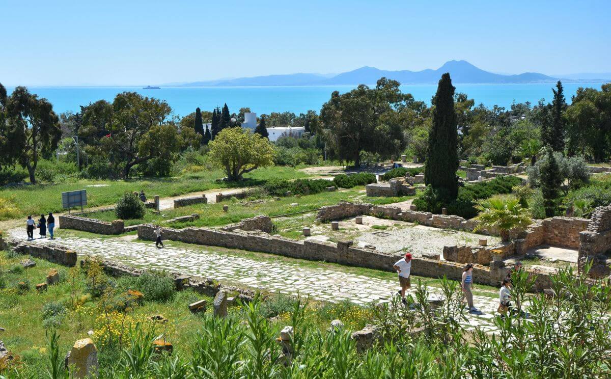
The wealthy residents didn’t choose this hillside by accident. The elevated position offered fresh air, sea views, and a more desirable location away from the busiest parts of the city.
- The Villa of the Aviary.
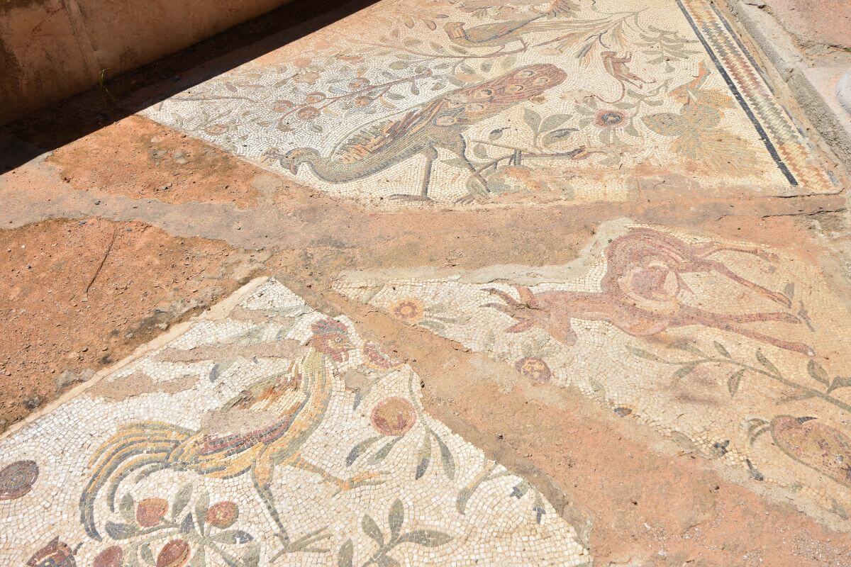
This is the most famous house on this hill, and the stop we wouldn’t miss. Its name comes from its famous mosaic, where birds appear among rich vegetation. This villa is one of the best examples for understanding how wealthy residents decorated their private homes.
- A Roman obsession with horse racing.
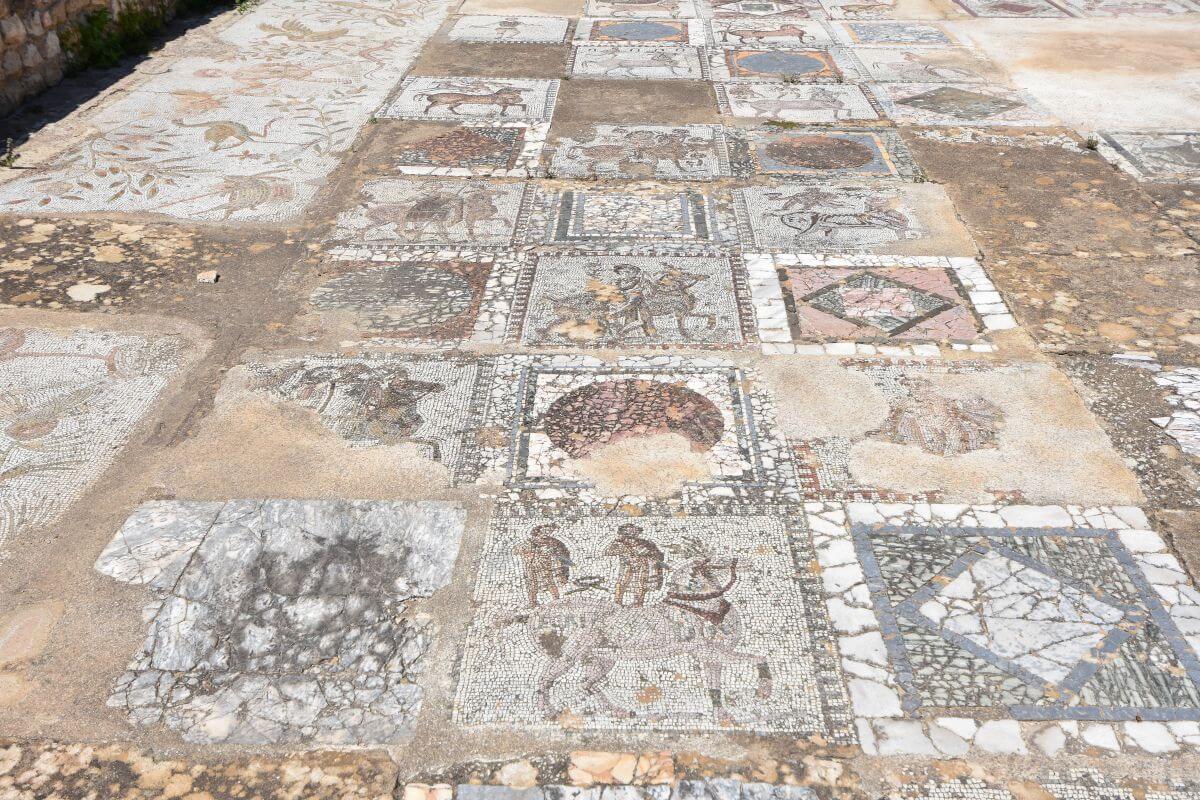
Near the Villa of the Aviary is the famous House of the Horses. According to the site’s informational panels, this 4th-century mosaic was discovered in the main room of a luxurious Roman house. This mosaic includes dozens of racehorses, with names written beside them. Their names provide remarkable evidence of the importance of chariot racing in Roman North Africa.
- Music once echoed across the hill. At the district’s western end stood an Odeon. Archaeology confirms the Odeon’s construction on the remains of older burials, while ancient evidence connects it with concerts and literary competitions.
WHAT ARCHAEOLOGISTS BELIEVE:
- The planned colony.
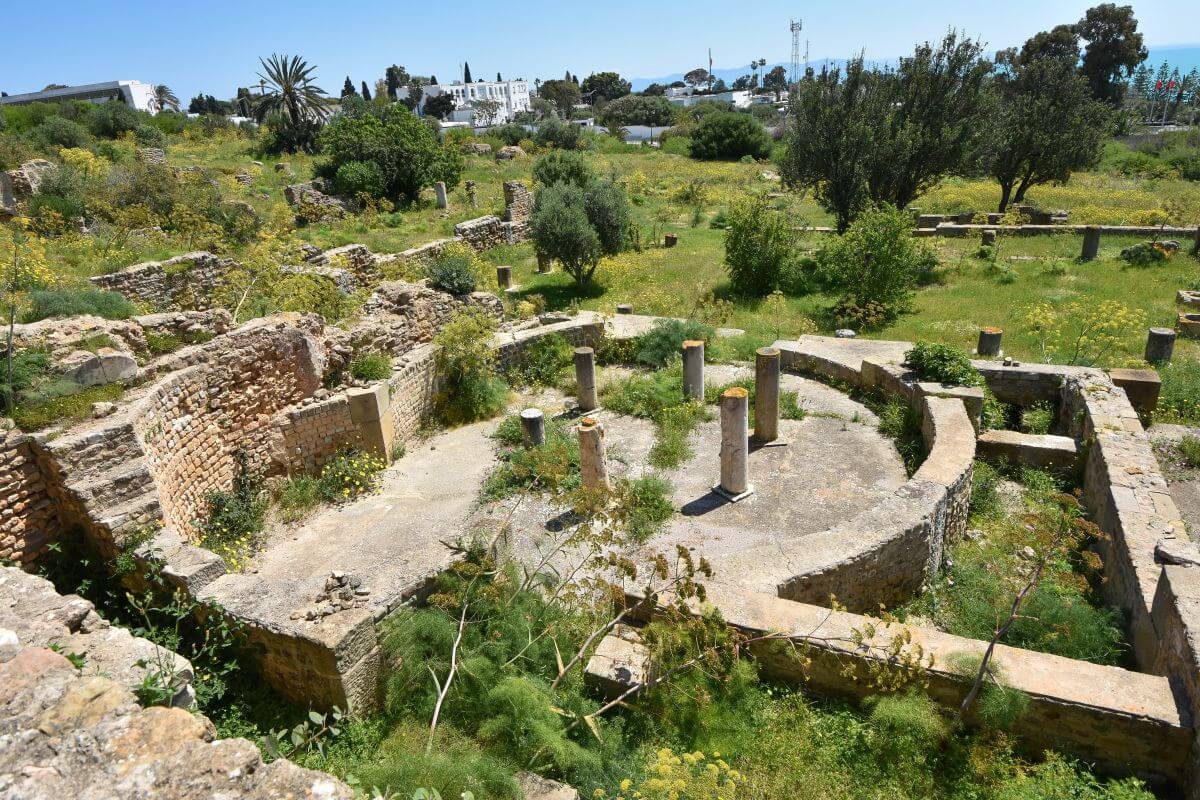
Archaeologists believe the neighbourhood developed according to a carefully planned urban layout. This may have formed part of the wider rebuilding programme that transformed the former Punic city into a Roman colony. Even the difficult, sloping hillside was carved into precise, rectangular blocks.
- The double life of Roman houses. The largest homes may also have been more complicated than they first appear. Researchers believe some wealthy owners could have combined private living spaces with commercial premises. Evidence suggests renting out street-facing rooms to shopkeepers while keeping the more luxurious parts of the house for themselves.
REMAINS A MYSTERY:
- The missing upper floors.
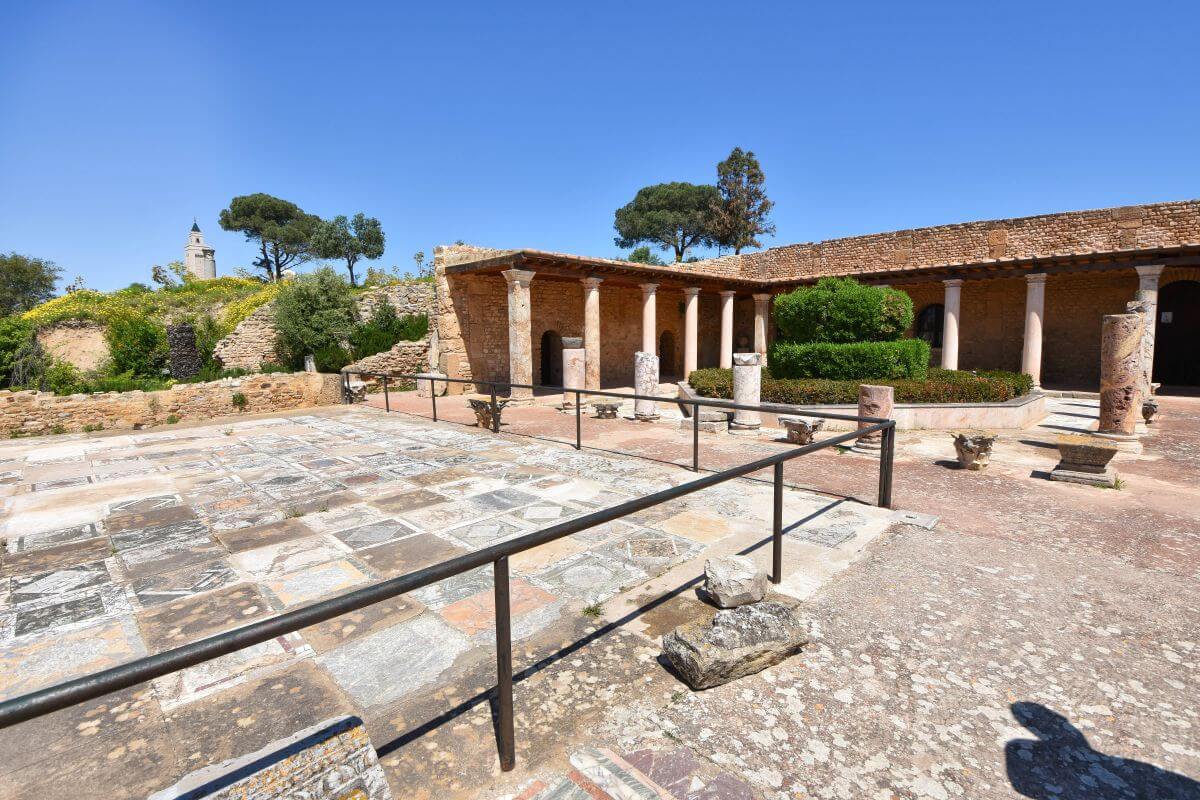
Later destruction, stone robbing, and centuries of change mean we cannot reconstruct every upper room, wall, or roof with certainty.
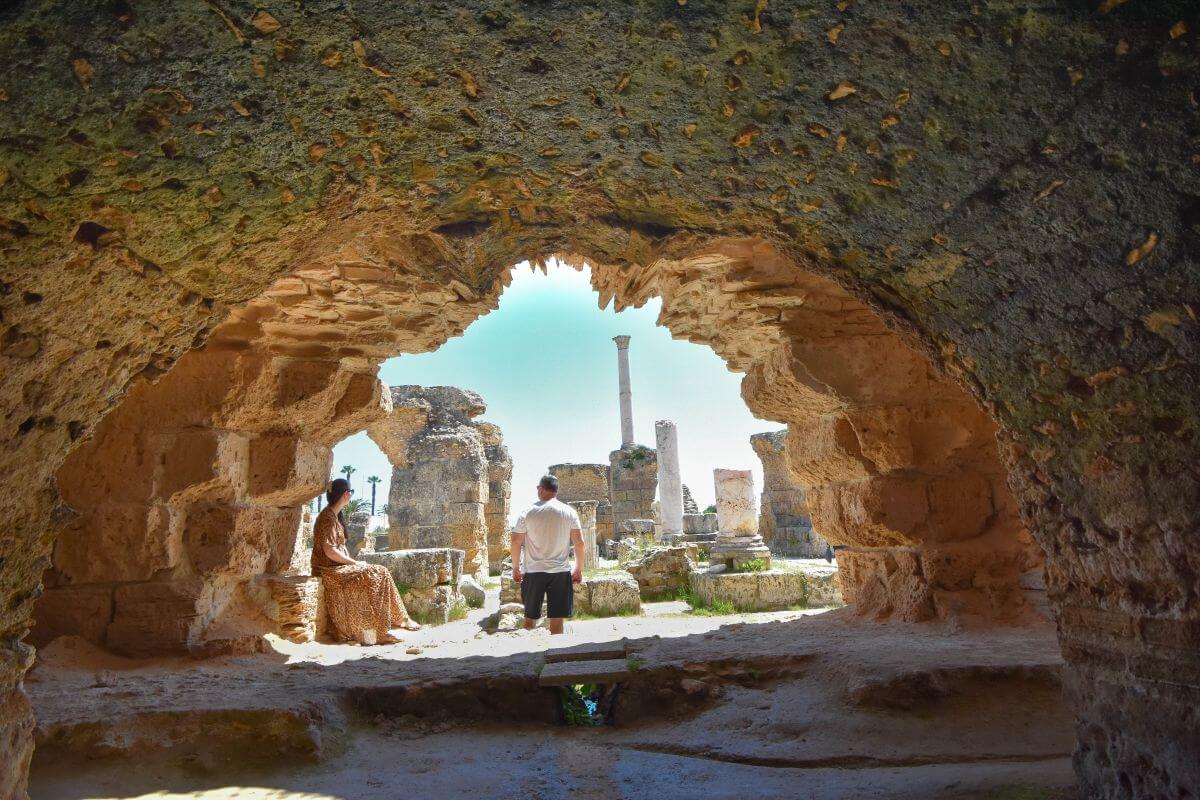
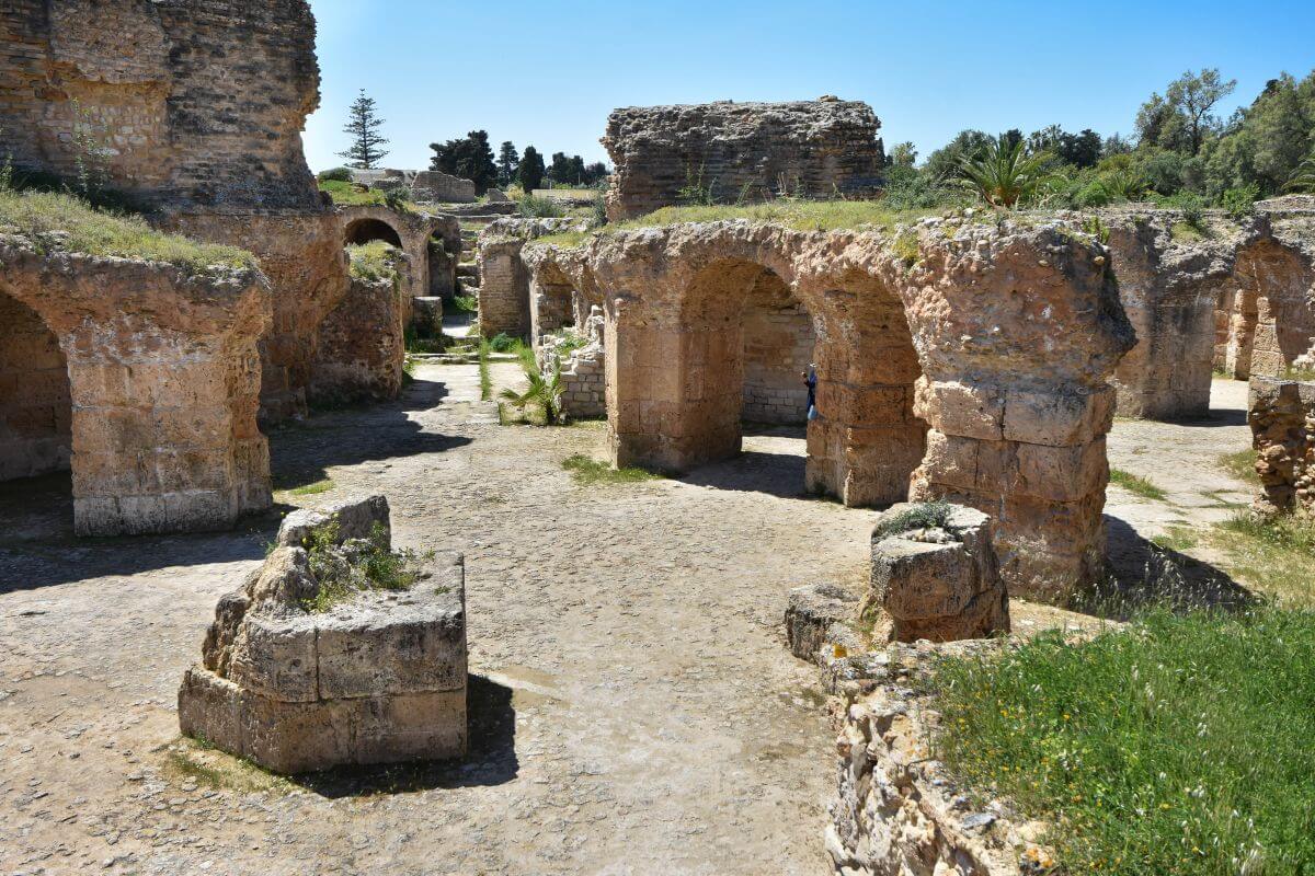
5. Antonine Baths
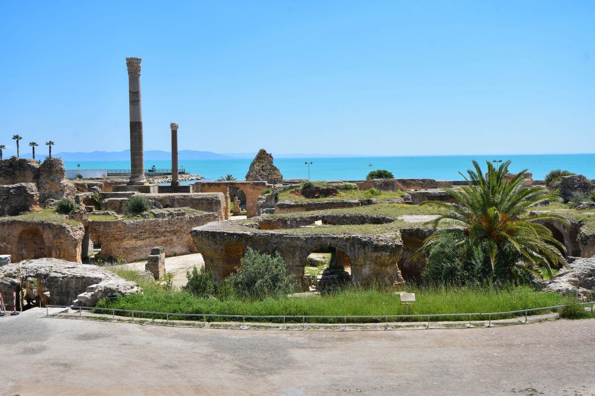
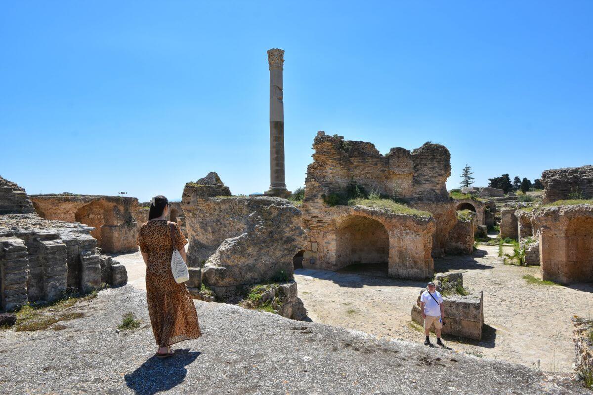
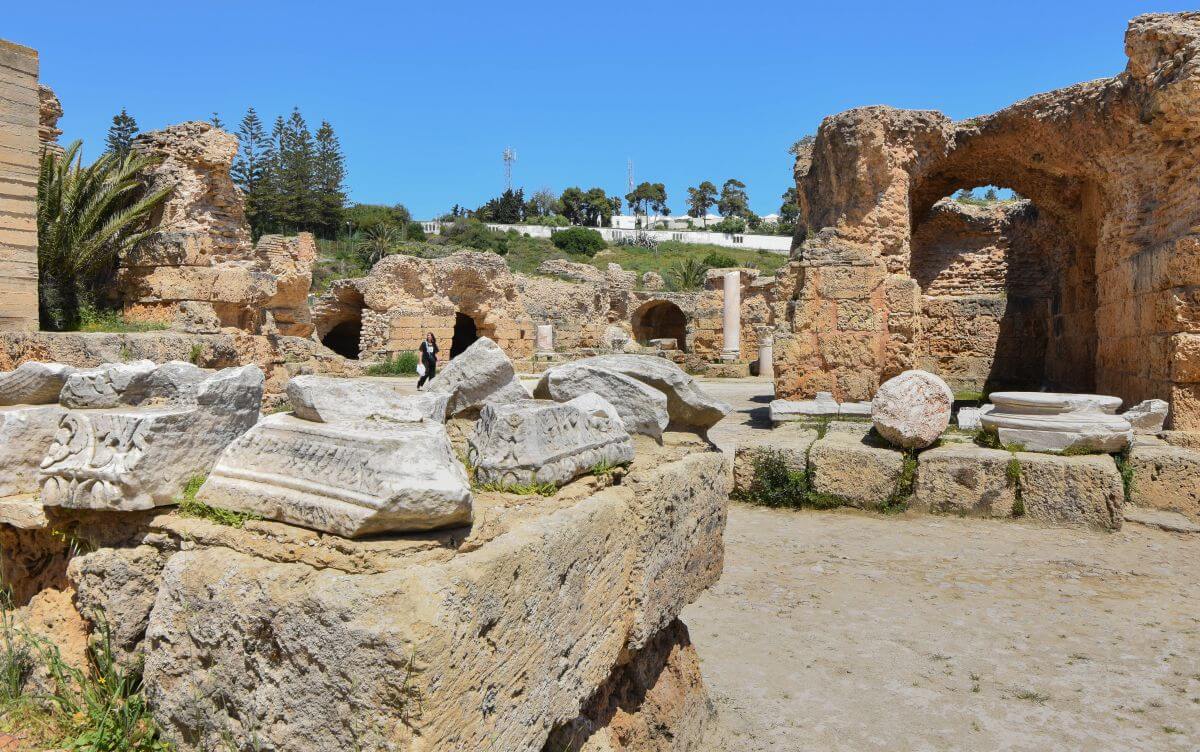
Now head towards the sea. The Antonine Baths stretch along the waterfront, and even in their ruined state, they are easily the most impressive remains we saw at the site.
WHAT WE KNOW:
- Africa’s largest Roman bath complex.
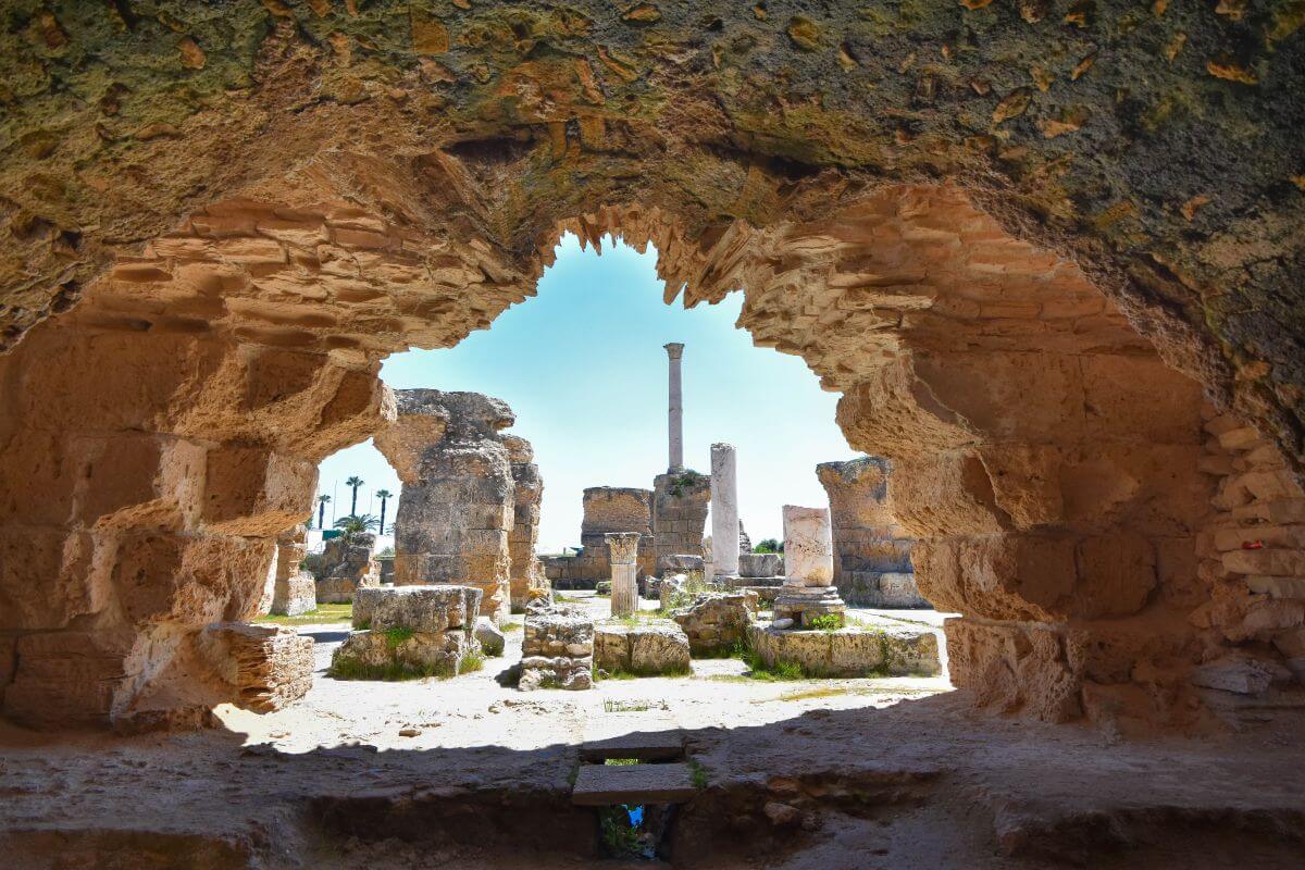
The baths occupied approximately 17,850 sq m, increasing to almost 19,700 sq m when the lower-level rooms opened to the public. The Antonine Baths were built directly beside the sea and were considerably larger than the Hadrianic Baths at Lepcis Magna. The official Tunisian heritage authority describes them as the largest Roman baths in Africa.
- When were they built? The complex opened in 157 or 159 AD. The Antonine Baths were completed in 162 AD, when the porticoes and other external buildings were added to the site. The name comes from Emperor Antoninus Pius, although the official heritage authority says his modern attribution is based on modern tradition.
- The baths were originally mixed. The Tunisian Ministry of Cultural Affairs notes that growing scandals led Emperor Hadrian to separate the sexes. Women used the baths in the morning and men in the afternoon. Entry was inexpensive and sometimes completely free.
- Look beneath your feet.
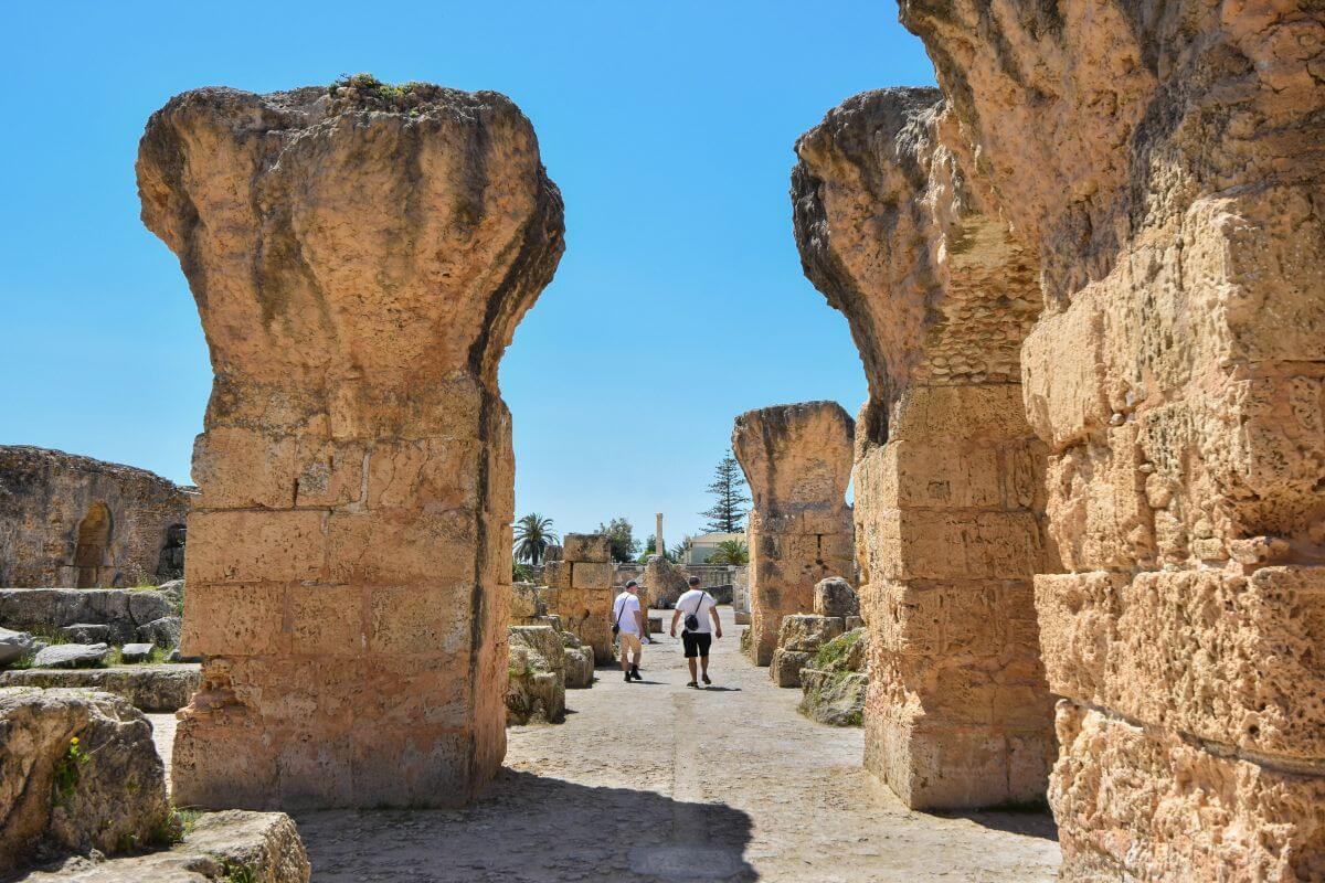
Much of what survives today belongs to the lower service level. This included the boiler rooms and spaces needed to keep the enormous complex operating.
- An enormous roof.
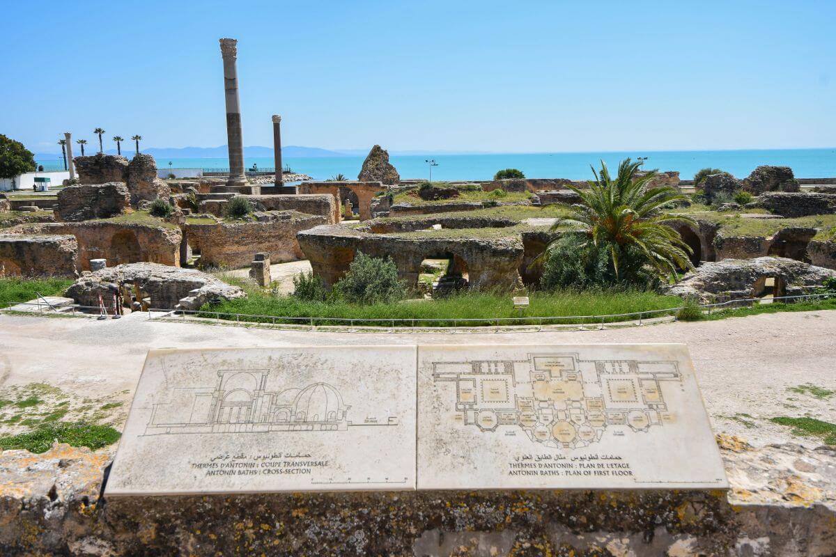
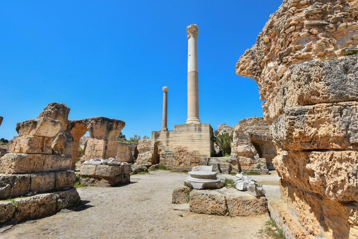
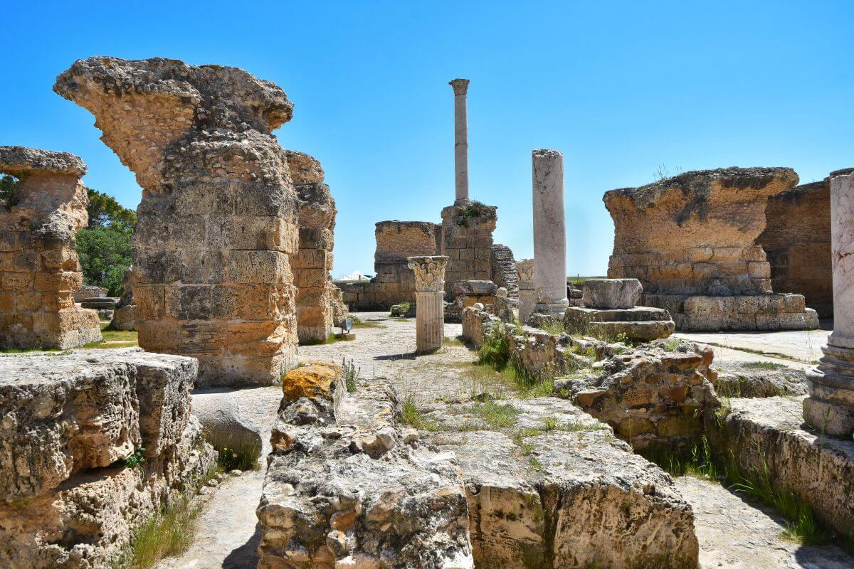
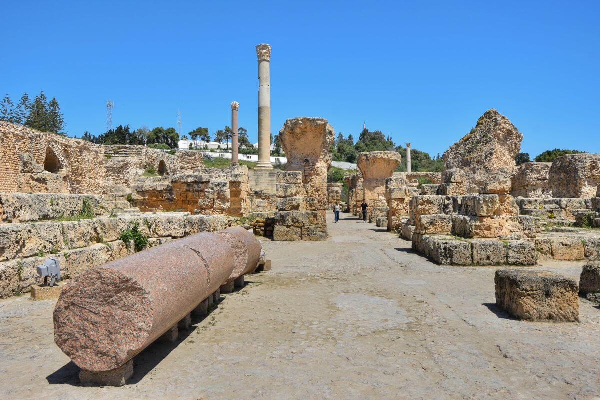
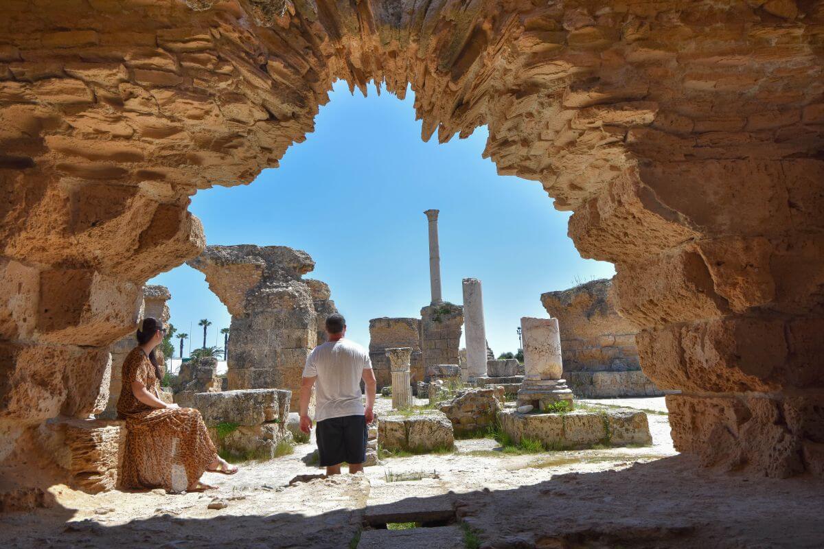
The main bathing halls once rose far above the surviving ruins. Massive granite columns you can see today supported the monumental structure. Stone and marble came from places including Italy, Greece, Sicily, and other parts of North Africa. Look at the reconstructed 15-m (49-ft) column in this picture; it shows just how colossal this complex really was. It was one of eight massive pillars that once supported the roof of the massive cold room.
WHAT ARCHAEOLOGISTS BELIEVE:
- A carefully engineered coastal complex.
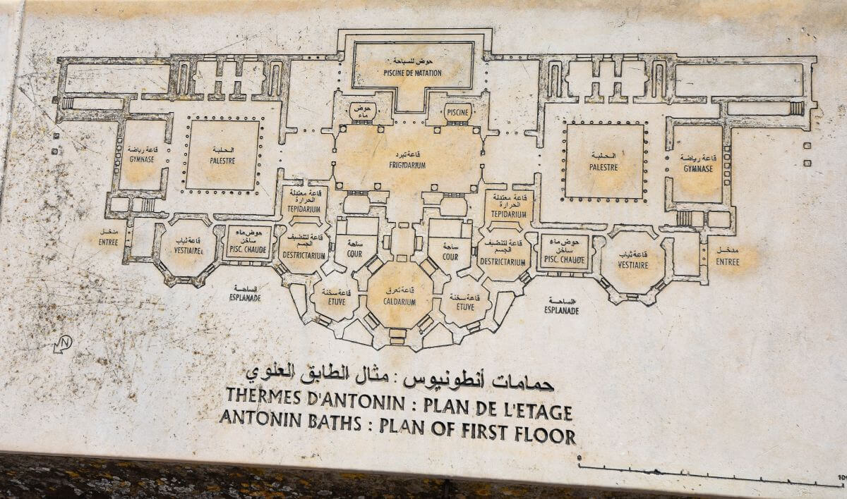
The narrow coastal strip influenced the long, symmetrical design. Archaeologists can reconstruct a symmetrical plan with entrances and duplicated rooms. The complex functioned all year, except for certain spaces, such as a swimming pool, which was seasonal.
- Water was part of a much larger system. The grand Zaghouan-Carthage hydraulic system, which included a 132-km aqueduct and large storage cisterns, supplied the Antonine Baths.
WHAT REMAINS A MYSTERY:
- What did the building look like?
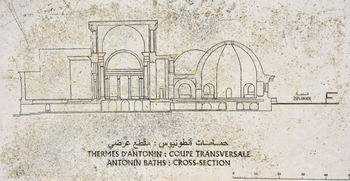
The surviving lower level gives archaeologists important evidence, but most of the upper architecture has vanished. We can reconstruct much of the plan (don’t miss a map of what the complex once looked like), but not every detail.
- When exactly did the baths stop functioning? The Antonine Baths remained in use after the great vaults of the cold room collapsed in the late 4th century. Further destruction followed in the 5th century, but the exact date of final abandonment remains uncertain.
OUR VERDICT:
Give the Antonine Baths more time you think you need. We found them far more impressive once we stopped looking at the ruins as isolated walls and started imagining the enormous building that once stood here.
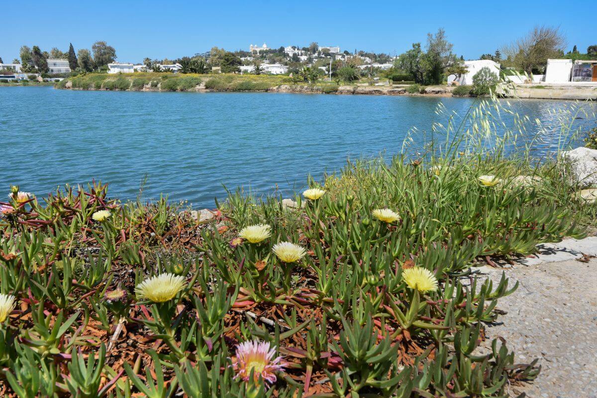
6. Punic Ports of Carthage
WHAT WE KNOW:
- It was a twin-harbour system.
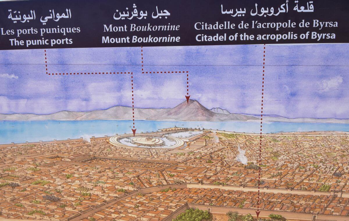
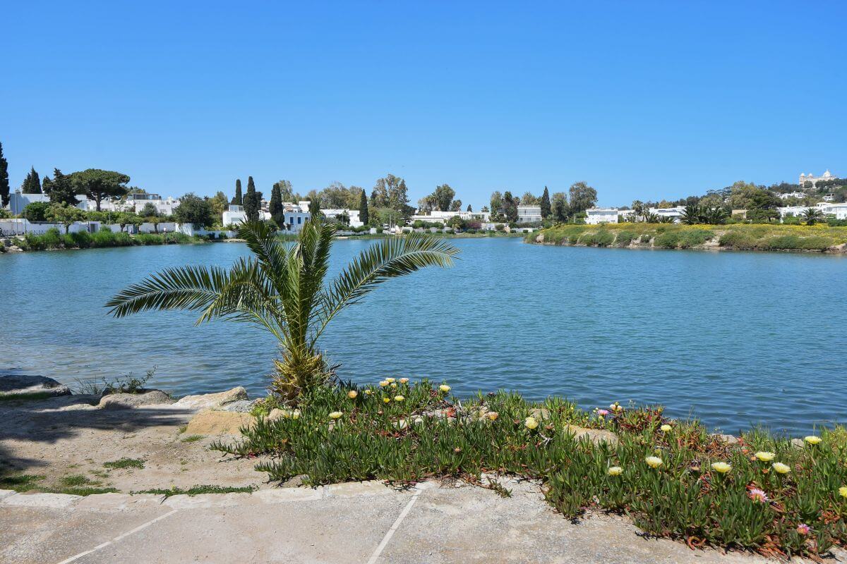
The harbour system consisted of two connected basins. The rectangular outer harbour served commercial shipping while the circular inner harbour was reserved for the navy. The two were connected and shared an entrance to the sea.
- A hidden naval harbour. The circular military harbour was surrounded by high structures and walls, which made it difficult for approaching ships to see what was inside. Ancient inscriptions even mention a controlled entrance that could be closed with chains.
- An artificial island at the centre. The circular harbour contained the Admiralty Island. Archaeological excavations have revealed the remains of shipbeds around the island. This provided physical evidence for the naval facilities described in ancient texts.
- It could accommodate a massive fleet. Ancient writer Appian described shipyards capable of accommodating 220 vessels. Archaeologists have found enough shipbed remains to show that this was a substantial naval installation. However, the exact number of ships that could operate there at one time shouldn’t be treated as certain.
WHAT ARCHAEOLOGISTS BELIEVE:
- The admiral had a 360-degree view. Researchers believe the naval commander’s tower sat on the highest point of the central island. From there, the naval commander could oversee the harbour and observe activity at sea.
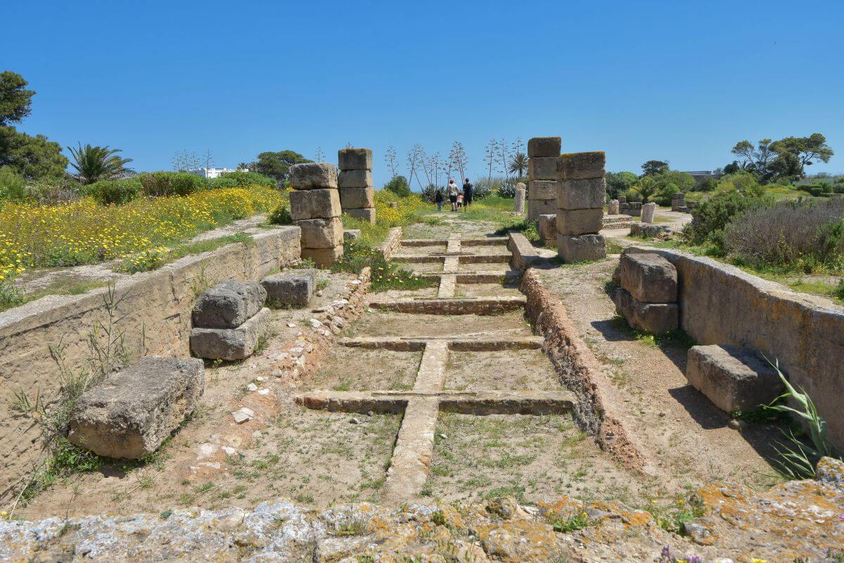
- It was intentionally built later. One of the most interesting discoveries is that the advanced dual harbour layout wasn’t built when the city was founded. Archaeologists believe this twin harbour dates back to the 3rd or early 2nd century BC. It was a desperate military upgrade to fight off the rising power of the Roman Empire. Evidence suggests a rectangular commercial port was built between 300 BC and 250 BC. The famous circular naval harbour came later, approximately between 200 BC and 150 BC. This timeline shows how Carthage’s naval infrastructure developed during a period of increasing Roman pressure.
WHAT REMAINS A MYSTERY:
7. Paleo-Christian Museum
GOOD TO KNOW:
- When we visited the Carthage ruins in Tunisia in April 2026, the official heritage page said the Paleo-Christian Museum was closed for maintenance. However, we later realised that the museum closed in April 2024 for extensive renovation and reopened in December 2025. However, their official heritage site hasn’t been updated and still states the museum is currently closed. But this is no longer true. As of September 2026, the Paleo-Christian Museum is open to the public.
- OPENING TIMES: winter 8:30 AM to 5 PM, summer 8 AM to 6 PM, Ramadan 8 AM to 5 PM. Closed on Mondays.
8. Carthage Tophet
WHAT WE KNOW:
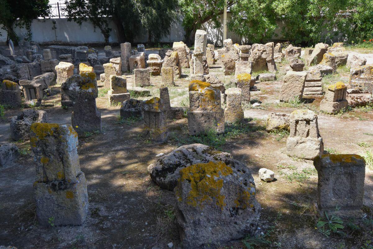
- Thousands of urns lie beneath the sanctuary.
Archaeologists have uncovered over 20,000 urns, containing cremated human and animal remains. The Tophet is one of the largest known Punic burial complexes of its kind. The site developed over several centuries and remained in use until the destruction of Punic Carthage in 146 BC.
- The remains are extremely young. Researchers discovered that many urns contain cremated human remains belonging to infants and very young children. Some deposits also contained lamb and goat bones mixed with children’s remains.
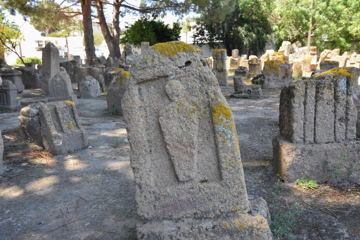
- The stones are the real clues.
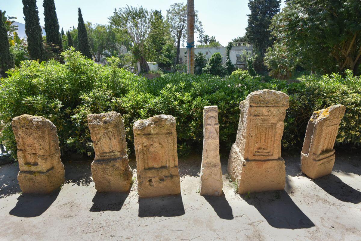
More than 6,000 inscriptions are associated with the Carthage Tophet. Many stelae carry short dedicatory inscriptions and religious symbols connected with Tanit and Baall Hammon (two important Punic deities worshipped by the Carthaginian). Look closely at the stone markers to see a special symbol called the sign of Tanit. It’s shaped like a triangle with a circle on top and a straight line across. The simple drawing looks a lot like a doll, or a child with open arms.
- This was a religious place, not simply an ordinary cemetery. The arrangement of urns, stelae, and offerings points to a sanctuary with strong ritual purpose.
- Archaeology is still producing surprises. In 2023, archaeologists uncovered five rare gold coins dating to the 3rd century BC. The offerings to Tanit and Baal Hammon carry the image of Tanit. Archaeologists also discovered a marble female mask during excavations in 2025. The late 4th century BC object may have been offered to the site’s deities.
WHAT ARCHAEOLOGISTS BELIEVE:
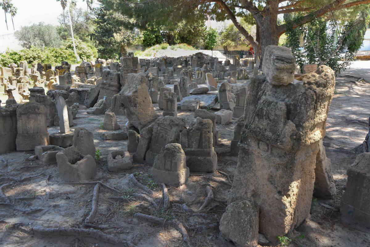
- The Carthaginians sacrificed young children (both boys and girls) at sacred places like this one. Most of these babies were just a few weeks old. Researchers at the University of Oxford found that this was not unique to Carthage in Tunisia. Their Phoenician neighbours also practised child sacrifice at colonies in Sicily, Sardinia, and Malta.
- The child-sacrifice theory has strong evidence. Some researchers argue that the combination of cremated infants, the religious inscriptions, and ancient written accounts makes ritual sacrifices highly likely. Studies of the cremated remains have found age patterns that are difficult to explain as an ordinary infant cemetery.
- The stones may record religious vows. The wording on many stelae follows repeated religious formulas. Therefore, some scholars believe parents dedicated a child to the deities in return for divine help or thanking them after a favour had been granted.
- Animals were sometimes a part of the ritual. Lamb and goat remains appear in some urns, occasionally alongside human remains. Some researchers interpret these as substitutes offered instead of children. This suggests that the ritual may not always have involved a human sacrifice.
WHAT REMAINS A MYSTERY:
- We don’t know its original name. Tophet is a modern scholarly term, not a name we know the Carthaginians themselves used. Because so little Punic literature survived, we cannot precisely explain how its rituals worked.
- Was the famous bronze sacrifice described by ancient writers real? Greek and Roman writers described terrifying rituals involving a bronze deity and fire. No archaeological evidence has confirmed such a mechanism in this Punic city.
Now you know the top things to see in the Carthage ruins!
Useful Information Before You Visit the Ruins of Carthage in Tunisia
Is It Worth Visiting the Carthage Ruins?
Opening Hours
- The summer schedule (from 1 May to 15 September) is 8 AM to 6 PM.
- The low season schedule (from 16 September to 30 April) is 8:30 AM to 5 PM.
- The Ramadan schedule is generally 8 AM to 5 PM.
Entry Fee
The Best Time To Visit
Which TGM Station Should You Use?
- Salammbo. Get off here for the Tophet (about a 5-minute walk) and the Punic Ports (7-10 min away).
- Byrsa. Use this station for Byrsa Hill and the Punic Quarter. Expect a steep 10-12 minute walk uphill.
- Dermech. This is useful for the Roman Villas district (around a 5-8-min walk).
- Hannibal. The Antonine Baths are an 8-minute walk, the Paleo-Christian Museum about 5 minutes, and the Roman theatre approximately 5-7 minutes inland.
- Presidence. Use it for the northern archaeological areas and the amphitheatre (12-15 min away on foot). For the amphitheatre, we recommend taking a short taxi.
First-timer Tips For Visiting
- A single combined ticket. One cheap ticket gets you into the main archaeological sites, including the Antonine Baths, Tophet, Roman theatre, Byrsa Hill, Roman Villas, and Amphitheatre.
- Keep your ticket safe. You must show the same ticket at every single site you visit.
- Plan your route before you arrive to make your visit much easier.
- Don’t underestimate walking. Seeing the major areas can mean several km (miles) on foot, often over exposed and uneven ground.
- Take taxis or use the TGM strategically.
- Bring water, sunscreen, sunglasses, and a hat.
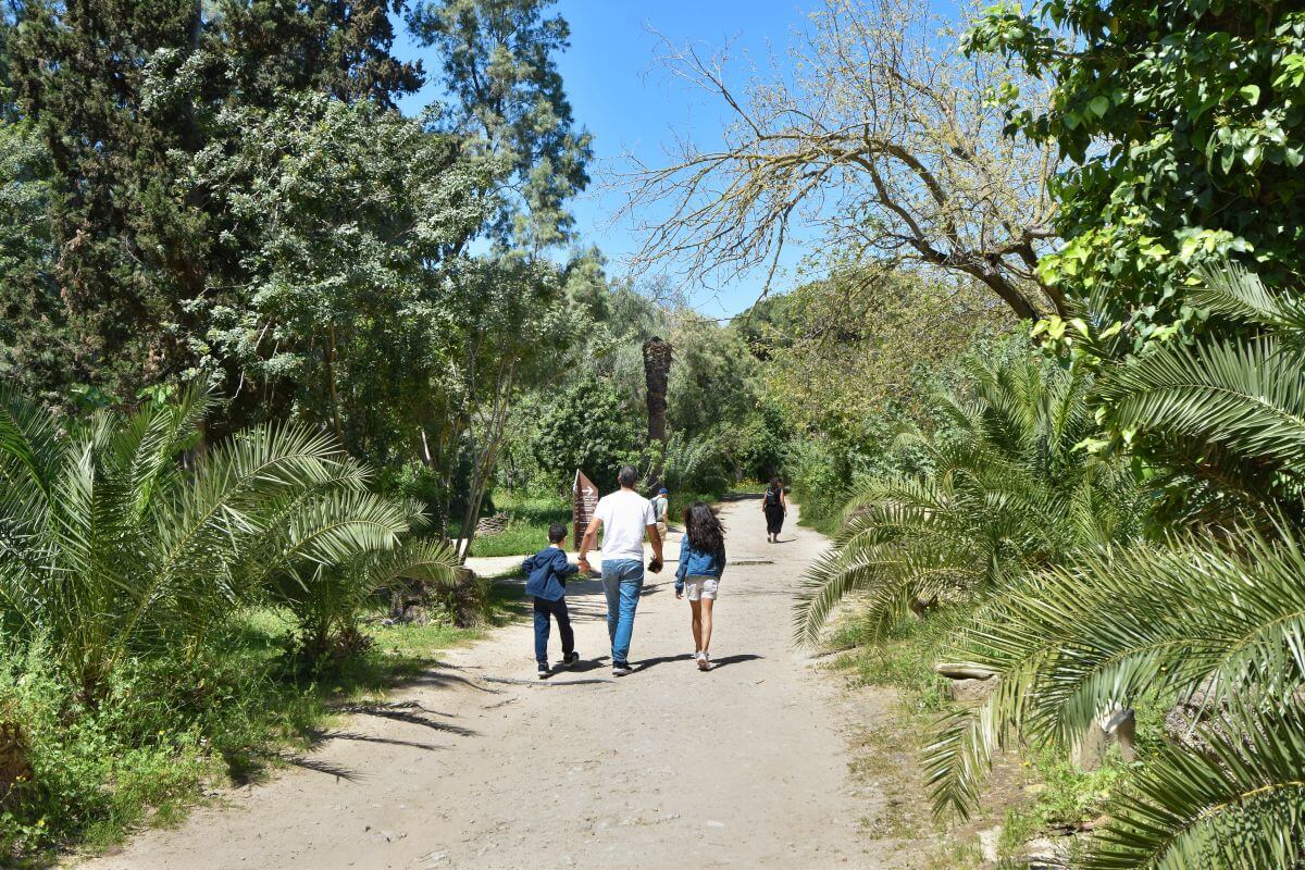
- Good walking shoes are essential because paths can be rocky, uneven, and dusty.
- Hire an officially licensed guide at the gate to understand the deep history. You can find them near the entrance of major sites like the baths.
- The Carthage ruins aren’t generally wheelchair friendly.
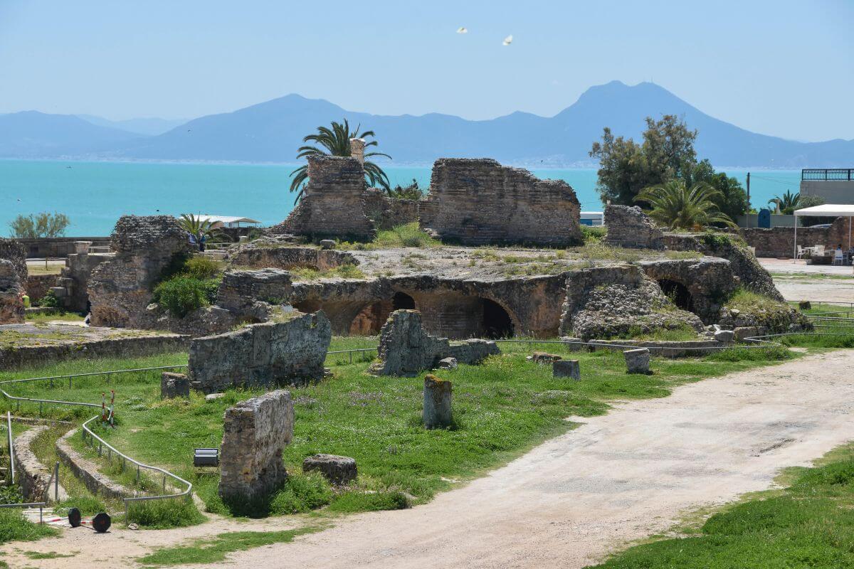
It’s a raw outdoor archaeological site with limited infrastructure. Most locations have dirt terrain and loose gravel paths. Expect steep hills (Byrsa Hill and the Roman Villas) and staircases (Roman theatre and the baths).
Now you know everything about the Carthage Ruins in Tunisia!
Thank you for staying with us until the end! If you’ve enjoyed this article, please consider sharing this post to extend its reach.
If you found this article about the Carthage ruins in Tunisia interesting, please share!
YOU MAY ALSO ENJOY: